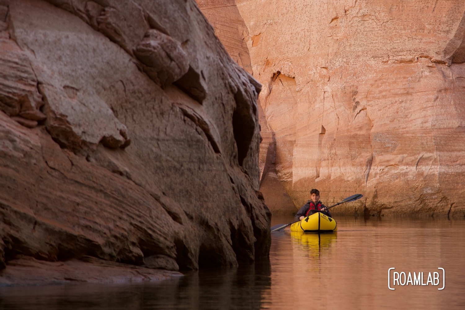
You have seen pictures from Antelope Canyon. The smooth, whimsical red rock formations make for some of the most striking images one could create outside of Photoshop. But most likely, you’ve seen the landlocked section where people hike. There is also a water-bound stretch, and that is a marvel of its own.
Located just outside of Page, Arizona, near the Utah border, Antelope Canyon feeds into Lake Powel, a stretch of the Colorado River stopped by the Glen Canyon Dam. This slot canyon is the product of seasonal flash floods that scour the red Navajo Sandstone into ethereal undulating curves. With narrow walls that reach as high as 120 feet, the canyon can block out the sun even at the peak of the day.
Accessing Antelope Canyon
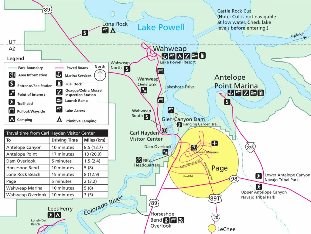
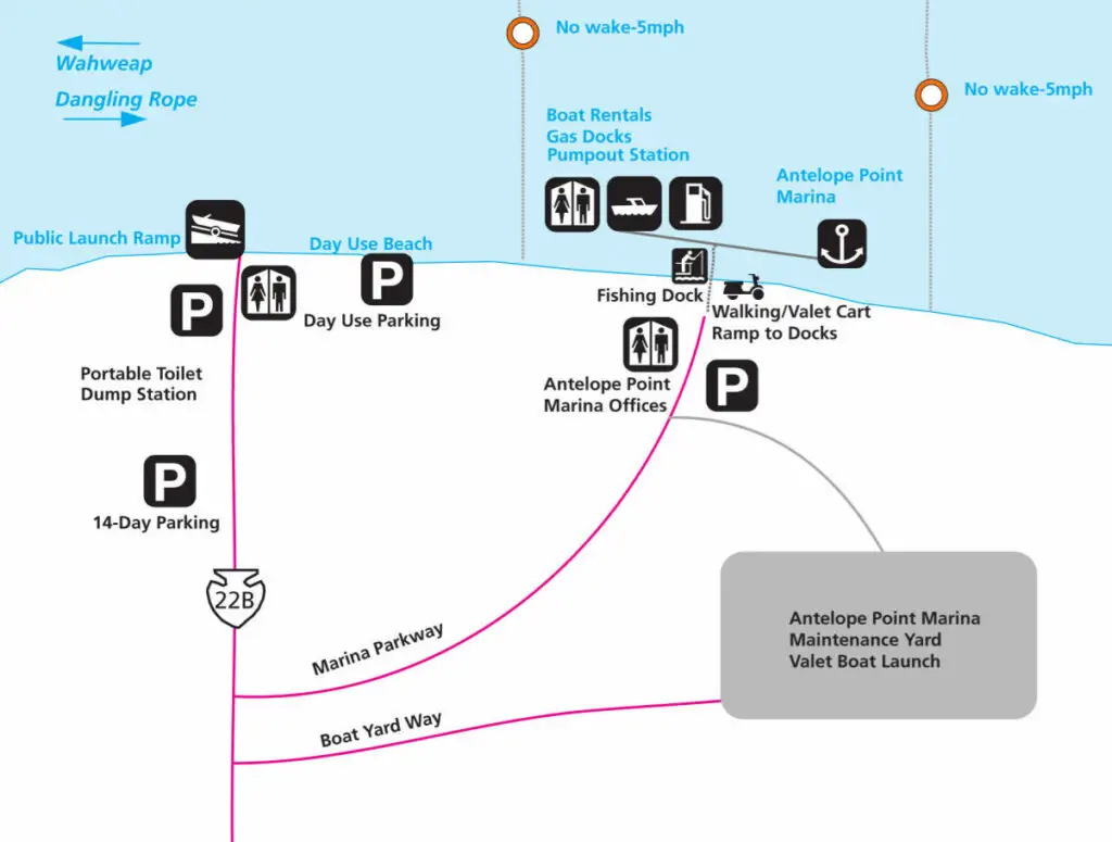
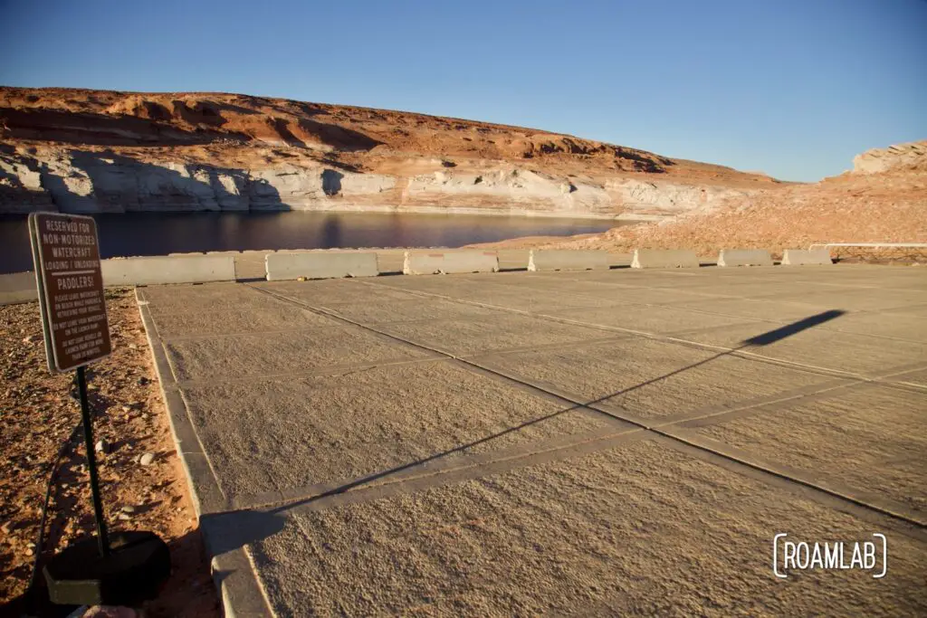
These iconic cliffs may be what draws in visitors, but they also limit entry points to the canyon. Most people enter the canyon on foot as part of a tour group. To reach it by water, we put in at the Antelope Point Launch Ramp, part of the Glen Canyon Recreational Area that borders most of Lake Powell. This boat launch is massive and used to be a put-in point for the motorized craft. “Used to be” is the key point of that sentence, however. You see, Lake Powel is shrinking and with it, the shoreline is receding. Receding to the point that even this “launch ramp” would only launch you into thin air. These days, it ends on a cliff.
A Launch Point with a Hike
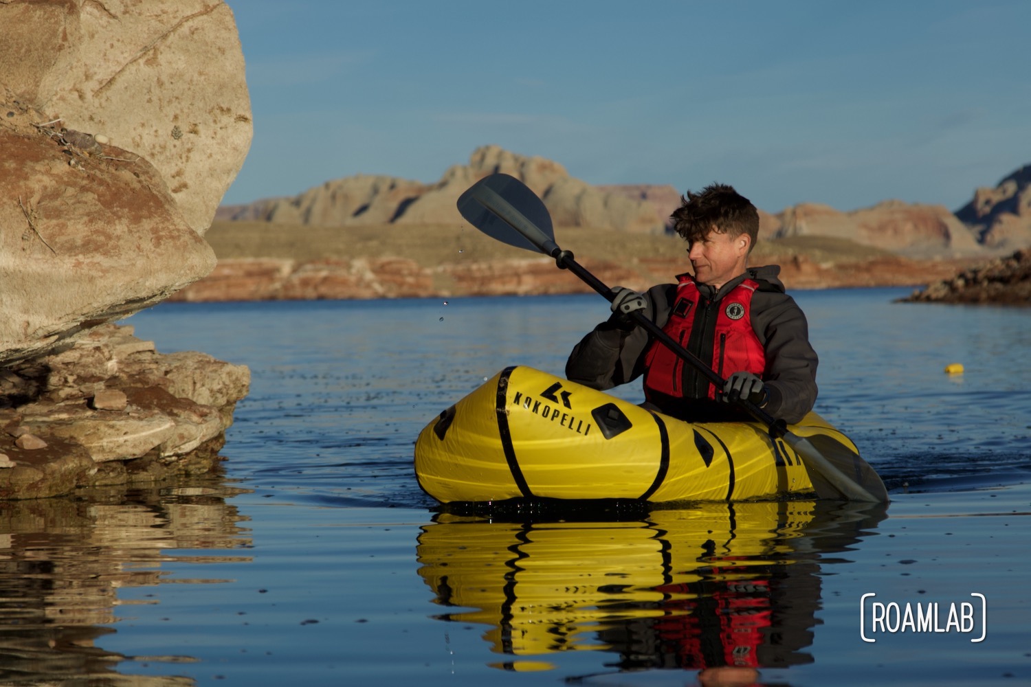
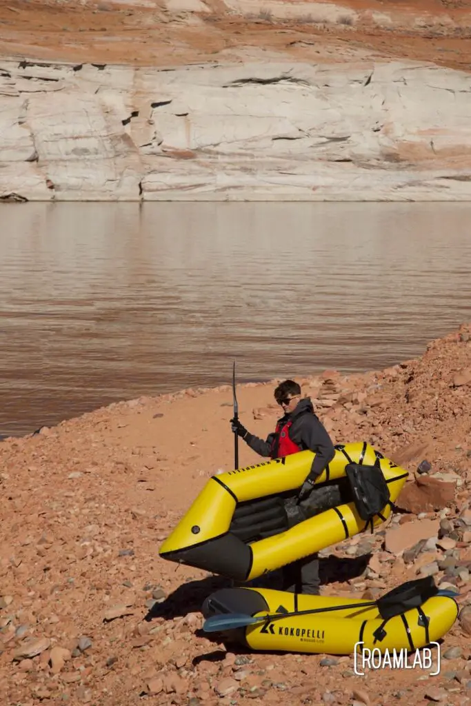
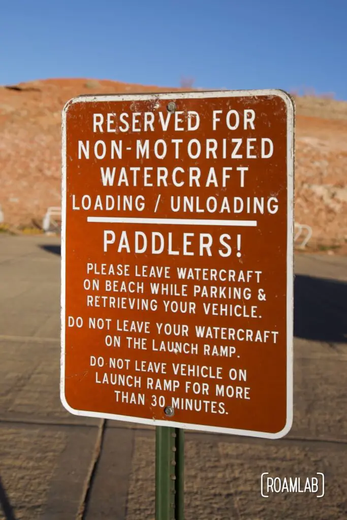
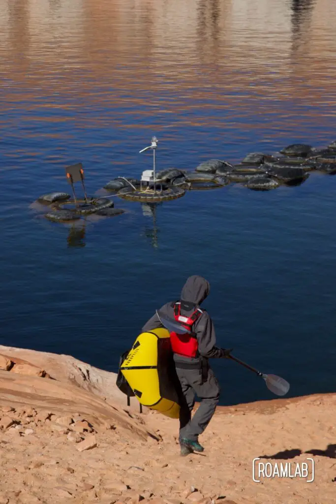
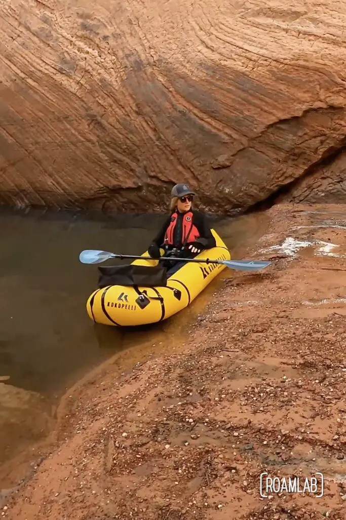
Fortunately, there’s a little side hike you can take from the west end of the ramp to reach the shore. The bottom section of the ramp is reserved for paddlers to load and unload their craft before carrying it down another 100 feet or so to the water along a steep sandy path. Sliding down the sandy slope, I understand why one park ranger advised us that many kayakers have regretted trying to launch from here. It would be awkward to carry a hard-sided watercraft down this shifting terrain. Fortunately, we have inflatable Kokopelli Rogue-Lite pack rafts and a couple of dry bags to carry water, snacks, and an extra layer in case we get cold on the water. While our descent may be inelegant, it’s very manageable. And, at the bottom, we have a sandy beach as an easy launch point.
Paddling Lake Powell to Antelope Canyon
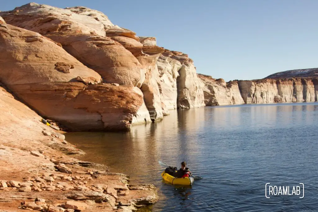
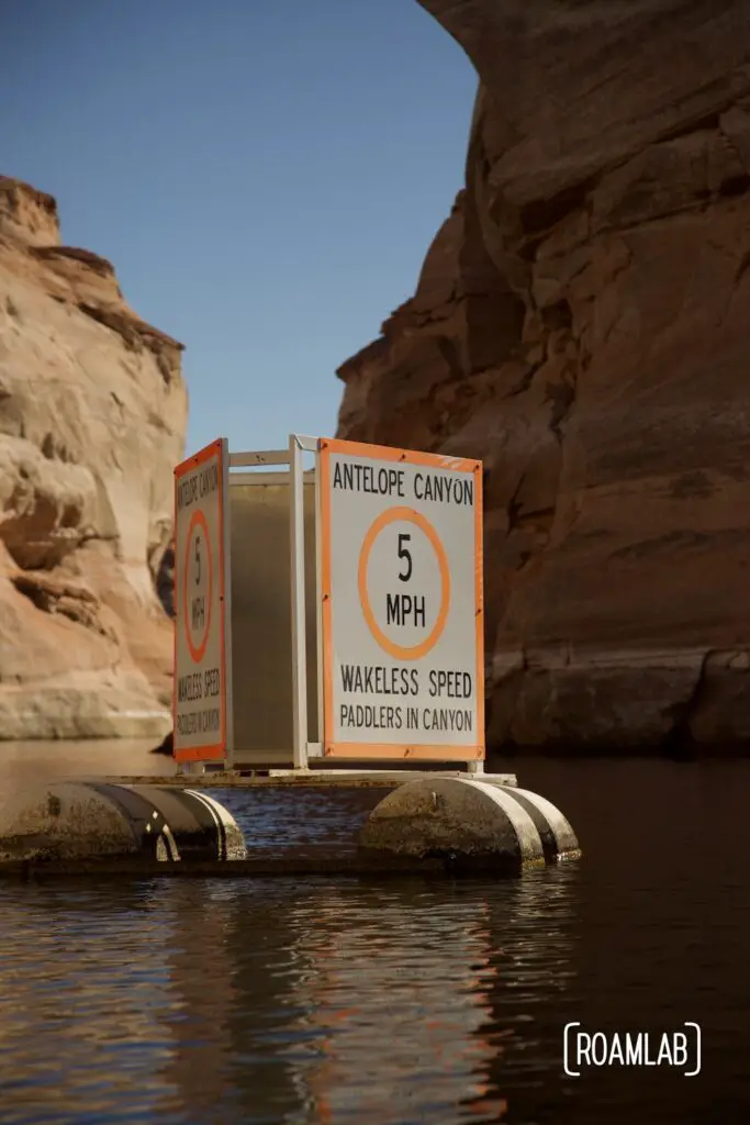
While this boat launch may share the name of Antelope Canyon, it is still a mile paddle southwest along Lake Powell before we reach the mouth of Antelope Canyon on the eastern shore. The entrance is marked with a speed buoy announcing Antelope Canyon as a wakeless zone with a 5MPH speed limit. It’s not much of a limitation to paddle boats, and this waterway is too narrow for most motorized boats. We are happy to take it slow.
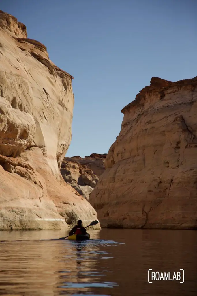
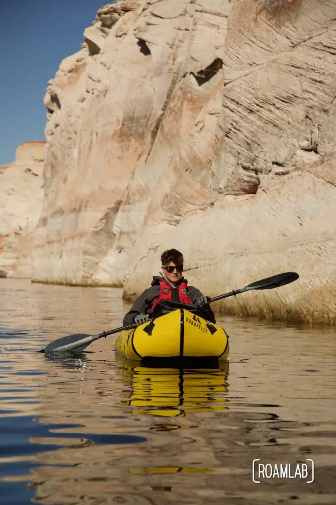
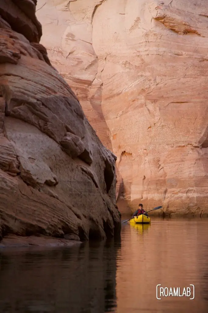
Paddling Antelope Canyon
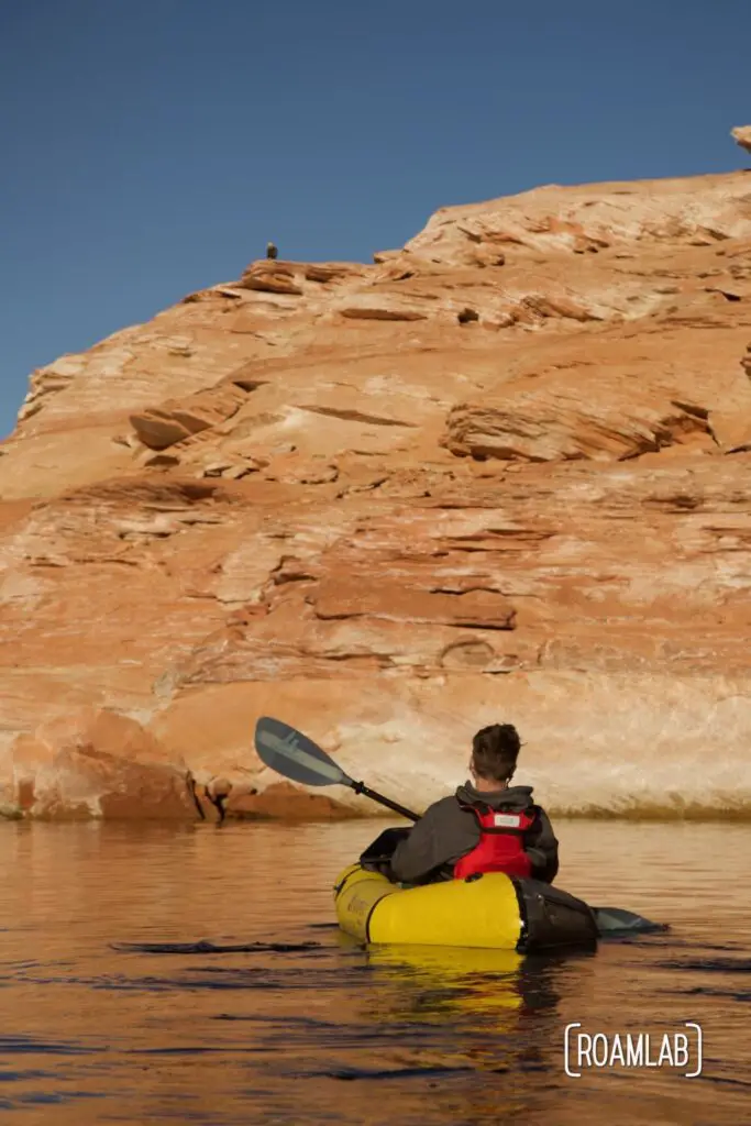
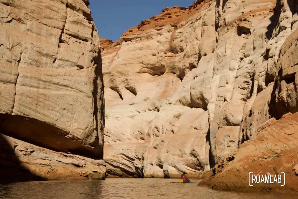
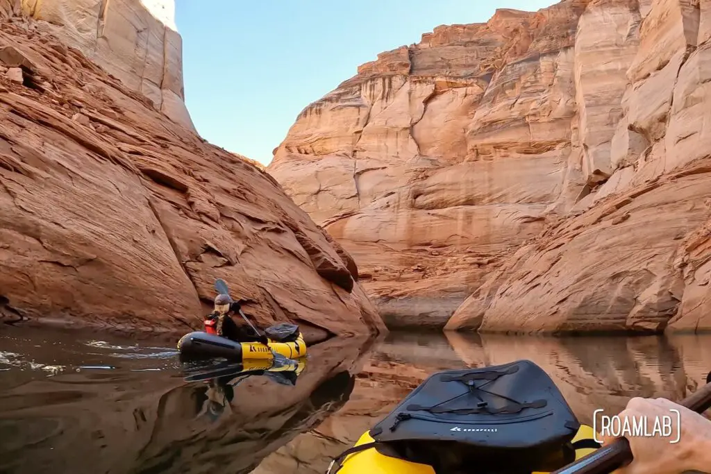
We turn in and start paddling. From the start, the canyon walls are remarkably high. If we had any trouble, there is no shoreline to retreat to until we either exit the canyon or reach the point where Antelope Creek gives way to “solid” land. That point varies with the water level, but, today we paddle about two miles up Antelope Creek before reaching a blend of sand and silt that may not completely constitute “dry land” but certainly brings an end to our paddling adventures.
The End
We meet up with a couple of kayakers at the end of the canyon. While Chris smoothly exits his raft to explore a bit of the canyon on foot, one of the kayakers takes a little too much time on the edge of the shore and the silty earth dissolves around him, dumping him knee-deep in water. It would be an inconvenience in the summer. But in the winter, this marks a hard stop to their ambitions to hike further into the canyon. Without dry shoes and a change of clothes, it’s time to turn around. The kayaker immediately removes his wet shoes and socks and wraps his feet in dry towels. With no easy exit, both kayakers turn around and paddle back out of the canyon. A mistake here is not something to downplay.
We have our own constraints as well. On a longer, warmer day, this may have been the point that we deflate our rafts, pack them into backpacks, and explored more of the canyon on foot. But we started this trip late in the morning and it’s already mid-afternoon. The weather is fine right now but it will cool quickly as the evening sets in. So, we turn around and head back to Antelope Point and a well-deserved dinner.
Bald Eagles and Lake Powell
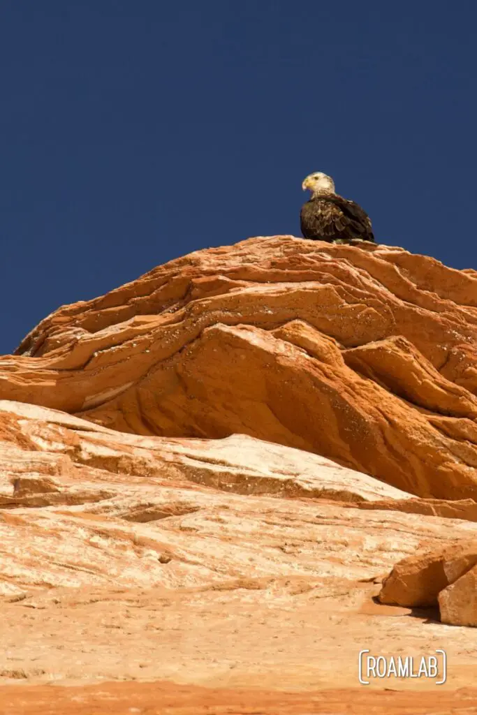
The return trip has its own entertainment. The walls of Antelope Canyon change with our new perspective as we leave. But the greatest surprise comes as we paddle from the mouth of Antelope Canyon back to the Antelope Point Boat Launch. Bald eagles and golden eagles are spotted around Lake Powell at various times of the year. When we first spot one raptor enjoying a meal along the shore, we are hesitant to leap to the conclusion that it is a bald eagle. But its bright white crown is undeniable. Further down, we also spot an adolescent scoping out the waterfront from its perch on a sandstone cliff. I hadn’t considered I would want my wildlife lens while rafting. But here I am, regretting my limited zoom capabilities.
We may have come to Antelope Canyon for a fun paddle. But we experienced so much more. My only regret is that we didn’t have more time.