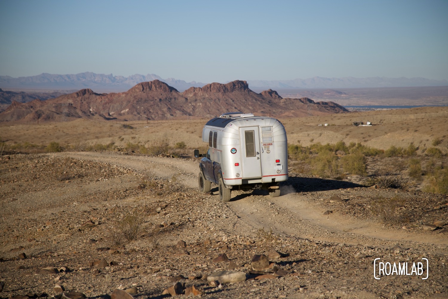
Kofa Wilderness Refuge is a special destination to us. It’s the first place we ever boondocked and we fell in love with the remote and dramatic rock formations. That said, as much as we have explored the area, we stuck to relatively major roads in the past. Yes, all of Kofa’s roads are dirt, and, yes, they can have some mean washboard or washouts. But the main arteries in the park that connect to the highway are recognizable on maps, wide enough for two vehicles to easily pass, and easily distinguished from the rest of the landscape. We even encounter large motorhomes and trailers along these key roads. But when we turn down Castle Dome Mine Road, we don’t see another soul. And we’re grateful for that because this trail gets incredibly narrow and rough with tight turns and high brush. But when we reach a clear vista point, that view is all ours.


About Castle Dome Mine Road
Castle Dome Mine Road is named after the Castle Dome Mine located in the southeast corner of Kofa Wilderness Refuge. It is part of Kofa’s illustrious history of mining. After all, Kofa is short for King of Arizona, a mine in the heart of the wilderness refuge that continues to operate to this day? Take our word for it, their white SUVs chased us when we went nearby to take a look. Castle Dome Mine, on the other hand, is closed but the property is still operated as a museum. Along with several preserved mines, the museum includes a ghost town and some odd vintage displays.

Driving Castle Dome Mine Road
One access point to Castle Dome Mine Road is located just a short drive south of Castle Dome Mine. But we start on the other end of Castle Dome Mine Road, where it exits onto King Valley Road, which runs through the center of Kofa Wilderness Refuge. Well, right off the bat, things get complicated. The official map of Kofa wilderness Refuge does not so much label roads as it labels junctions. There are technically two entry points to Castle Dome Mine Road along King Valley Road, Junctions 60 and 76. We start on 60, but the poor map coverage for this road gives us second thoughts. While the Kofa map indicates that both junctions will meet at Junction 50, we can’t find any confirmation of this on Google Maps. Sure, Google Maps has led us astray in the past. Remember White Pocket? But when we can have multiple maps confirming a route, we prefer that route. And Junction 76 appears to be better documented. So we backtrack and launch down Junction 76.
From other trail reports I read in advance of this drive, this route is so easy one poster admits that he let his grade-schooler drive parts of it. I hope it was at the beginning or the end. Because, yes, the first and last stretch of Castle Dome Mine Road is very straightforward. Even so, the road quickly narrows to a single lane with saguaro and mesquite brush crowding each side. But, for this stretch at least, the road is relatively straight and the rolling hills and occasional washes are fairly shallow.


McPherson Wash
Driving doesn’t get technical until we approach the McPherson Wash. Since we are driving in a wash, everything is very level. But the seasonal water clearly supercharges the local flora. The brush towers over our truck camper. This is likely no big deal for a jeep or some other small vehicle, but it takes special care for us to pass through this overgrown stretch without doing harm to our camper or the local nature.
McPherson Pass
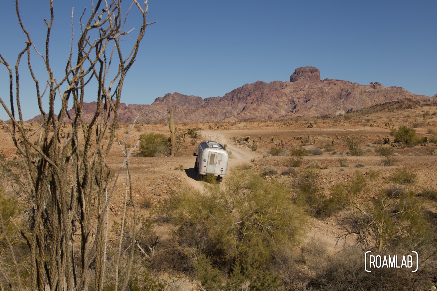
Granted, the wash is merely a prelude to McPherson Pass. Here, we are climbing into the Castle Dome Mountains. As we gain elevation, the terrain becomes much rockier. No more sandy washes. Instead, we skirt boulders and sharp dropoffs into creak beds. This is where high clearance is key. One particular ledge of exposed rock forces us onto a tight and much steeper cutaway that is, at least dirt rather than rock. But we can see in the deep ruts where past rigs have struggled in wet weather.
Thankfully, that patch is the roughest bit and the rest of the trail seems mild in comparison. As we descend from the mountain pass, we return to the desert floor and a roller coaster of descents in and out of washes. These would be pure entertainment if not for the flourishing flora that flanks the thoroughfare. We have to take it slow to minimize any potential pinstriping. But, once again, this would be no problem for a smaller rig.


South of the Castle Dome Mountains
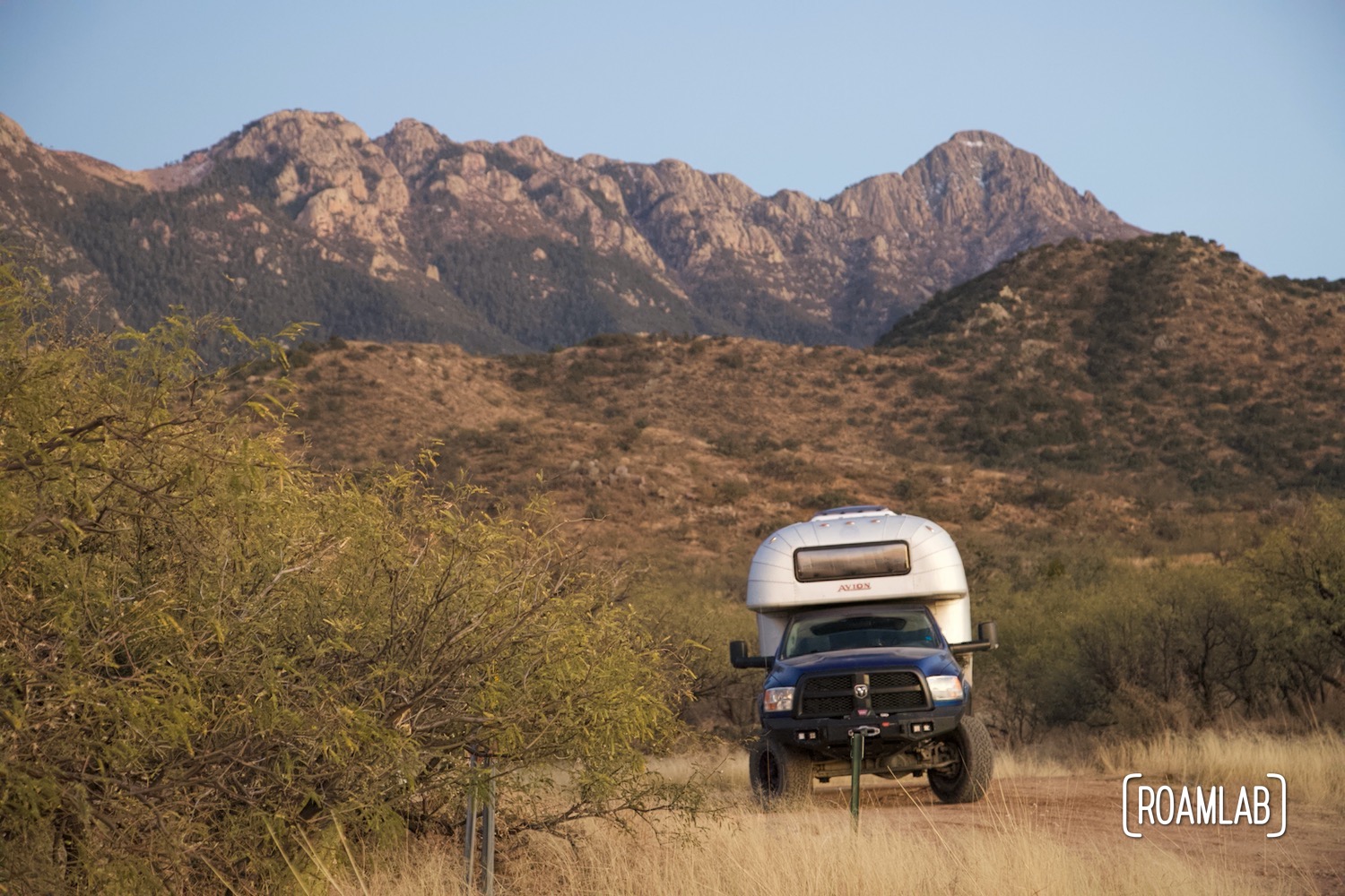
As soon as we clear the mountain pass, we are on the lookout for campsites. The rough terrain has our nerves on edge and the low sun shines directly through our windshield. Sunset is close and it’s time to make camp. Fortunately, we find a broad flat and remarkably scenic campsite to dry camp. After taking in the remarkable sunset, we retreat into our truck camper and gratefully curl up for an early night.
We finish Castle Dome Mine Road the following morning. What remains are flat desert straightaways interspersed with deep washes. It’s a reasonably straightforward return. The only confounding issue is that, as to be expected, Google Maps are misleading. The online search provider seems to think that Castle Dome Mine Road skirts the Castle Dome Mountains north of the Enchanted Cavern and Castle Dome Mine Museum. Instead, we cut south. And while we could cut back north to see the museum once we reach the main road (also labeled Castle Dome Mine Road) we opt to conclude our time in Kofa and head south, to Yuma.

Boondocking on Castle Dome Mine Road
While we did find dispersed camping along Castle Dome Mine Road, there isn’t a lot of it available. Much of the road is overgrown with brush, where there isn’t even enough space for two vehicles to pass let alone for one to pull off and camp. What camping there is will be near the terminus of the road. Better yet, there are more camping opportunities off the larger roads in Kofa, particularly near the highway entrances.

Final Thoughts
Castle Dome Mine Road is an adventure. But for larger rigs, it can get very stressful. If I had a Jeep, I’d drive it again in a heartbeat (provided I’m driving at a time where cross-traffic is unlikely). But I don’t think we’ll be taking the Avion down this particular route again.