There are several ways to approach the breathtaking waterfall of Cummins Falls State Park. One can stroll to the scenic vista. There is the relaxed trail to the top of the falls. Or, one can take on a mile long trudge through a creek to the base of the falls. My feet are wet, so you can guess which way we took.
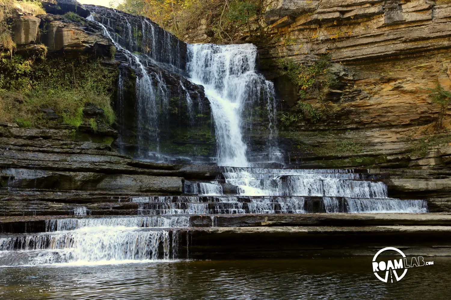
Cummins Falls State Park is a 211-acre day-use park in Cookeville, Tennessee. While there is a picnic area and fishing opportunities. People mainly come to the park for the titular 75 foot high Cummins Falls. Water from the Blackburn Fork State Scenic River tumbles down the Eastern Highland Rim to form Tennessee’s eighth largest waterfall (by volume of water). It is not just big, it is gorgeous. Water dips along many and varying tiers of rock to split and merge and tumble into a large pool at the waterfall’s base before continuing along the river bed.
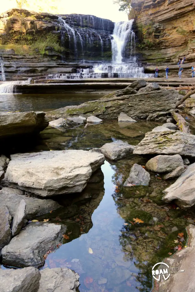
Many pools of water have formed along the base of the Cummins Falls. 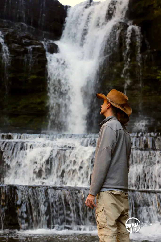
Gazing on the Cummins Falls.
Hiking Cummins Falls State Park
Cummins Falls State Park includes a network of trails allowing multiple approaches to the falls. From the parking lot, the Falls Overlook Trail is a .45 mile trail predictably culminating in a falls overlook. From it, you can either turn left for the extra .1 mile descent to the top of the falls or right to descend .5 miles downriver into the gorge and another .5 miles up the Blackburn Fork River to the base of the Cummins Falls. Of course for those on a mission to the falls, one can cut out the overlook view and half a mile from the hike if they take a .1 mile cut away connecting the Fall overlook trail and the Blackburn Fort River Trail.

We chose to take a loop route. We traveled along Falls Overlook Trail to Blackburn Fork River Trail, up the Cummins Falls Route to the base of the falls and then back tracking to the Blackburn Fork River Trail, and the .1 mi shortcut to the Falls Overlook Trail and the parking lot. In hind site, we hit it in the right order. You shouldn’t plan to do much hiking after visiting the bottom of the falls. Your feet will likely be wet by then and more prone to blisters.
The hike to the base of the falls involves crossing the Blackburn Fork River multiple times and there is no bridge or even much or a path. Sometimes, there are boulders to hop along. Not infrequently, though, all that is available are widely spaced, partially submerged, and unstable rocks. In most places along the hike, the river is shallow but wide. It would be easy to wade through but hard to hop across. If I were to visit again, I would bring a pair of flip flops to wear while crossing the river and a towel to try off my feet for comfort and to avoid blisters.
Packing for Cummins Falls State Park
The towel also makes sense in the summer when people hike not just for the view but to swim in the large water whole at the base of the falls. In the summer, this is a popular place to cool off. But, given its remote location, visitors are advised to only bring in what can fit in a backpack such as snacks, water, and a life jacket. Coolers, swim toys, and alcohol are all banned.
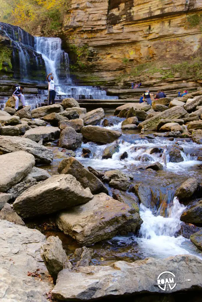
Clambering over boulders on the final approach to Cummins Falls. 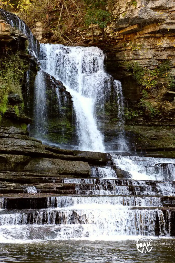
Cummins Falls 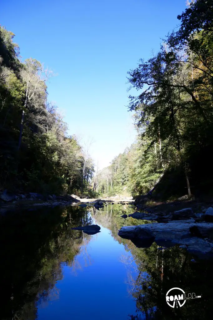
Hiking along the Blackburn Fork State Scenic River on our way to Cummins Falls.
Different Routes For Different Folks
People of many different levels of skill and mobility can enjoy the falls in their own way. We brought friends along to see the waterfall. Unfortunately, they were a little more limited in their mobility and decided to forgo the precarious trek to the base of the falls in favor of the more gentle route to the top of the falls. This proved to be an excellent compromise. They may have had it better: their feet weren’t wet.