Before we start
This is the third post in a five-part series on the Rimrocker Trail. If you have not read the previous posts, you may want to start at the beginning before continuing.


Nucla to Utah
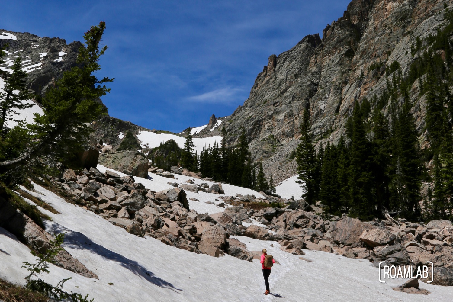
Once west of Nucla the road quickly dissolved into two ruts with the local grass growing in between. Large rocks, washed out rivulets, and narrow, cliff flanked switchbacks become the new norm. But this is the stretch where is all comes together.
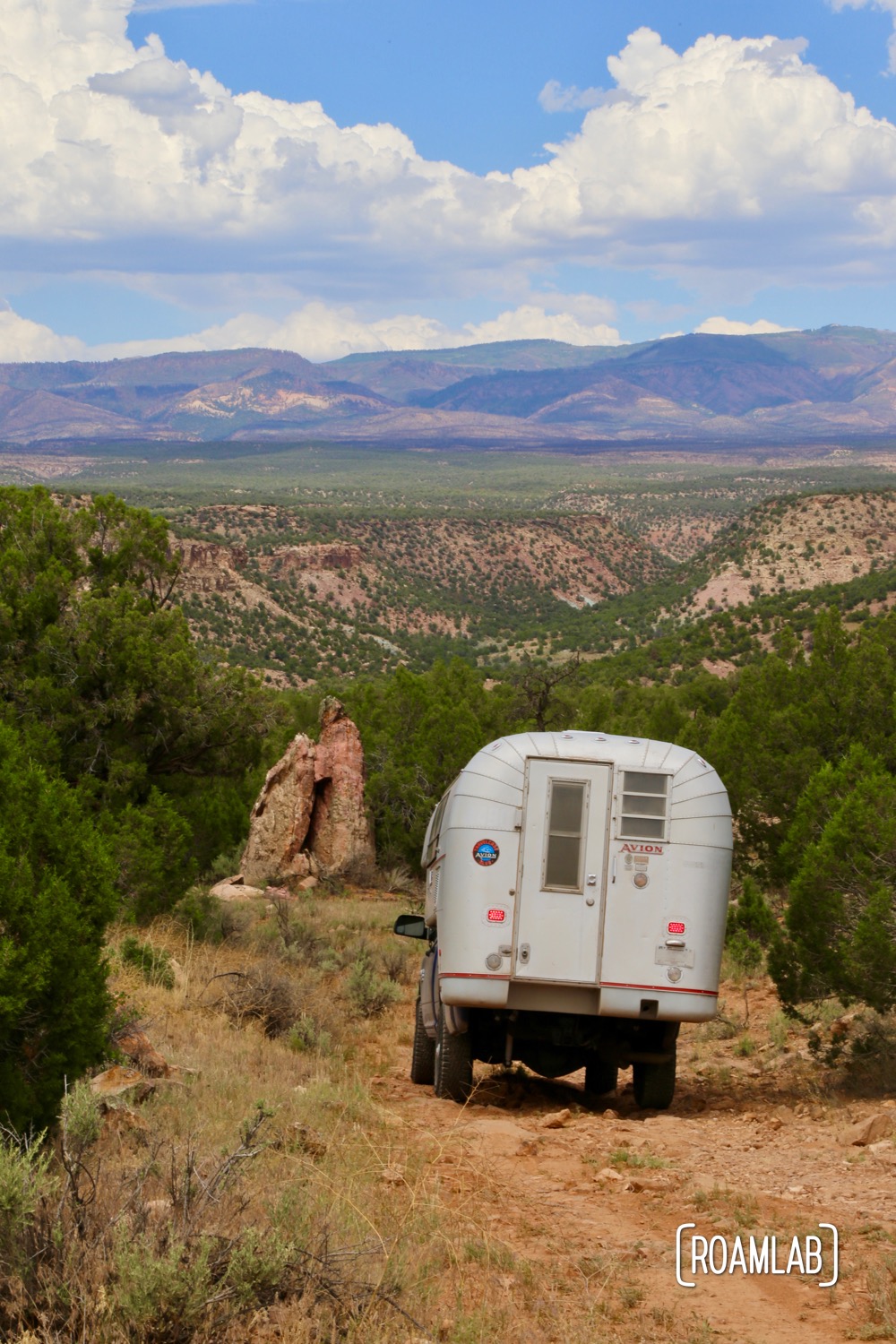
While Scenic & Historic Highway 141 wanders along the canyon floor, Rimrocker Trail skirts cliff sides for breathtaking views from the Spring Creek Mesa, Atkinson Mesa, and Carpenter Flats. The views are worth the challenge, at least along most of the route.
The Ballpark Detour
A series of creek crossings and a relatively unimpressive trail along U19 is a skippable affair. This section of the Rimrocker Trail roughly parallels Highway 141, the non-completionist can divert to the highway—just before the high water crossing—by following V19 to 141. Enjoy the pavement for 1.9-miles and jump ahead to the more scenic (though still technically challenging) stretch of Rimrocker by turning right onto Spring Creek Truck Trail and reconnecting at U17.
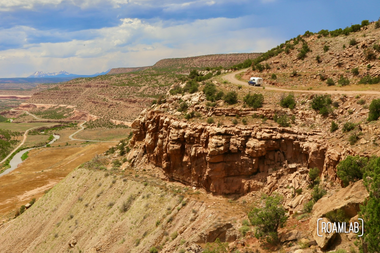
For those uncomfortable with creek crossings, it is possible to skip them all by continuing on 141 to S17 Rd to meet up with the trail at T16 Rd. But I wouldn’t recommend it. You’d miss out on amazing bluff views such as the third picture below.
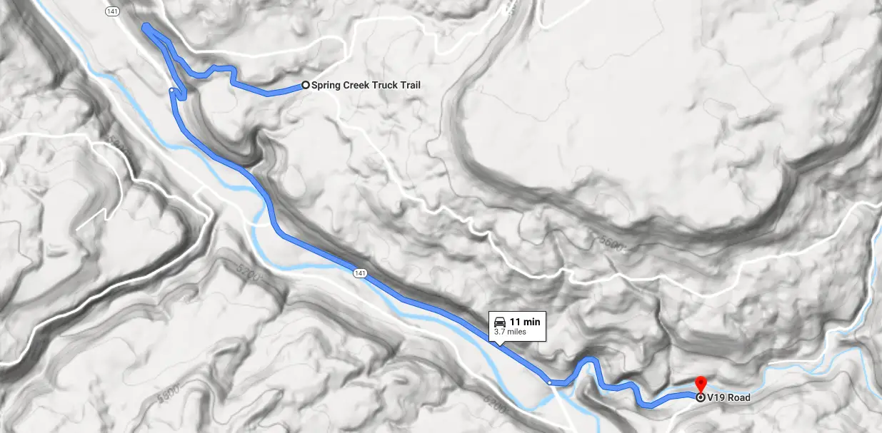
The Ballpark Detour Map
For those that do want the whole experience, the trails are narrow, rough, and steep. At one creek crossing, we had to shift large rocks to act as ramps while descending the cutaway bank. All of this is just build-up to the vistas following this section.
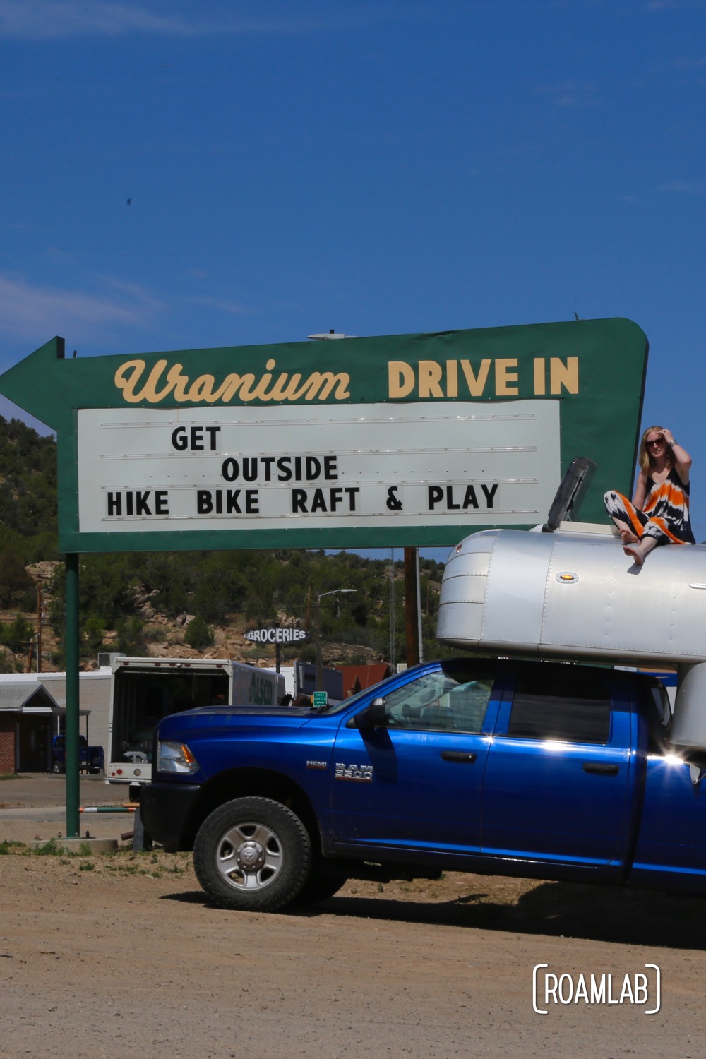
Hanging out by a reclaimed drive-through sign in Nucla, Colorado.
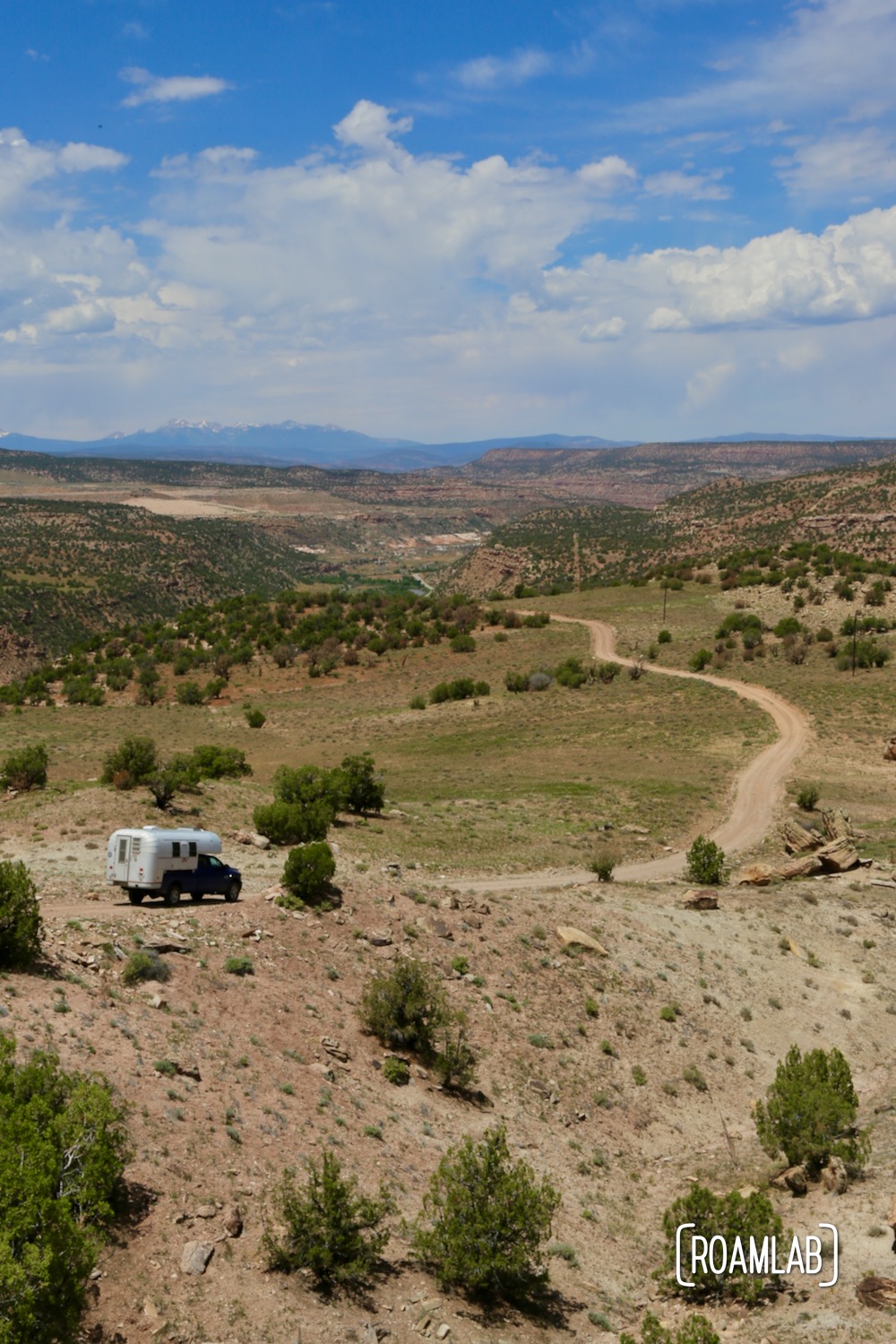
Scenic views west of Nucla on the Rimrocker Trail
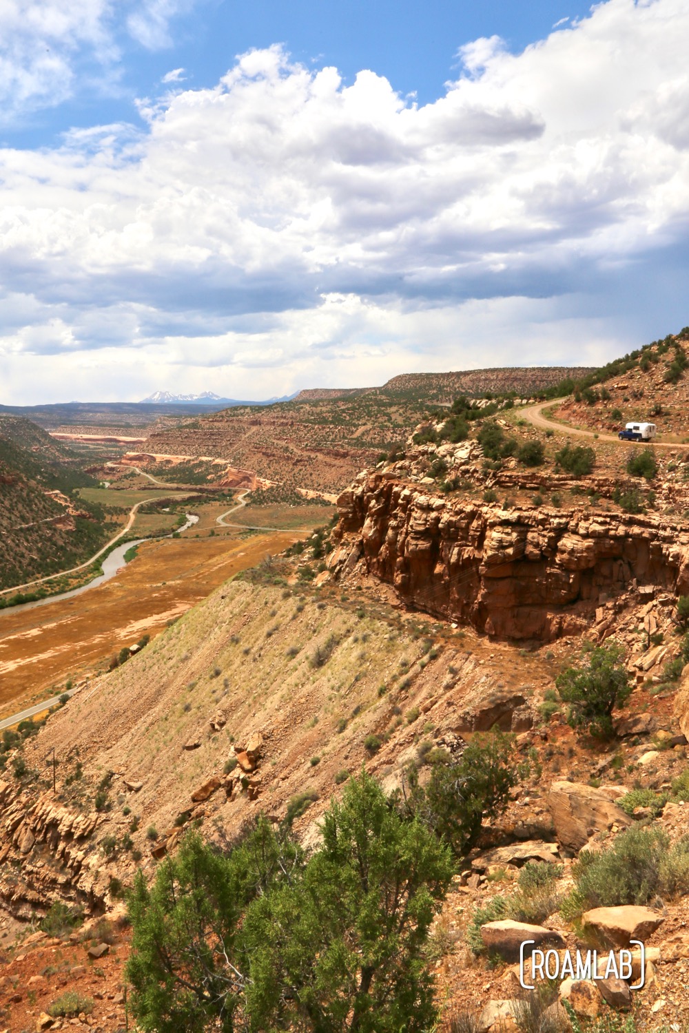
Dramatic vistas with a glimpse of the Rimrocker trail in the upper right hand corner.
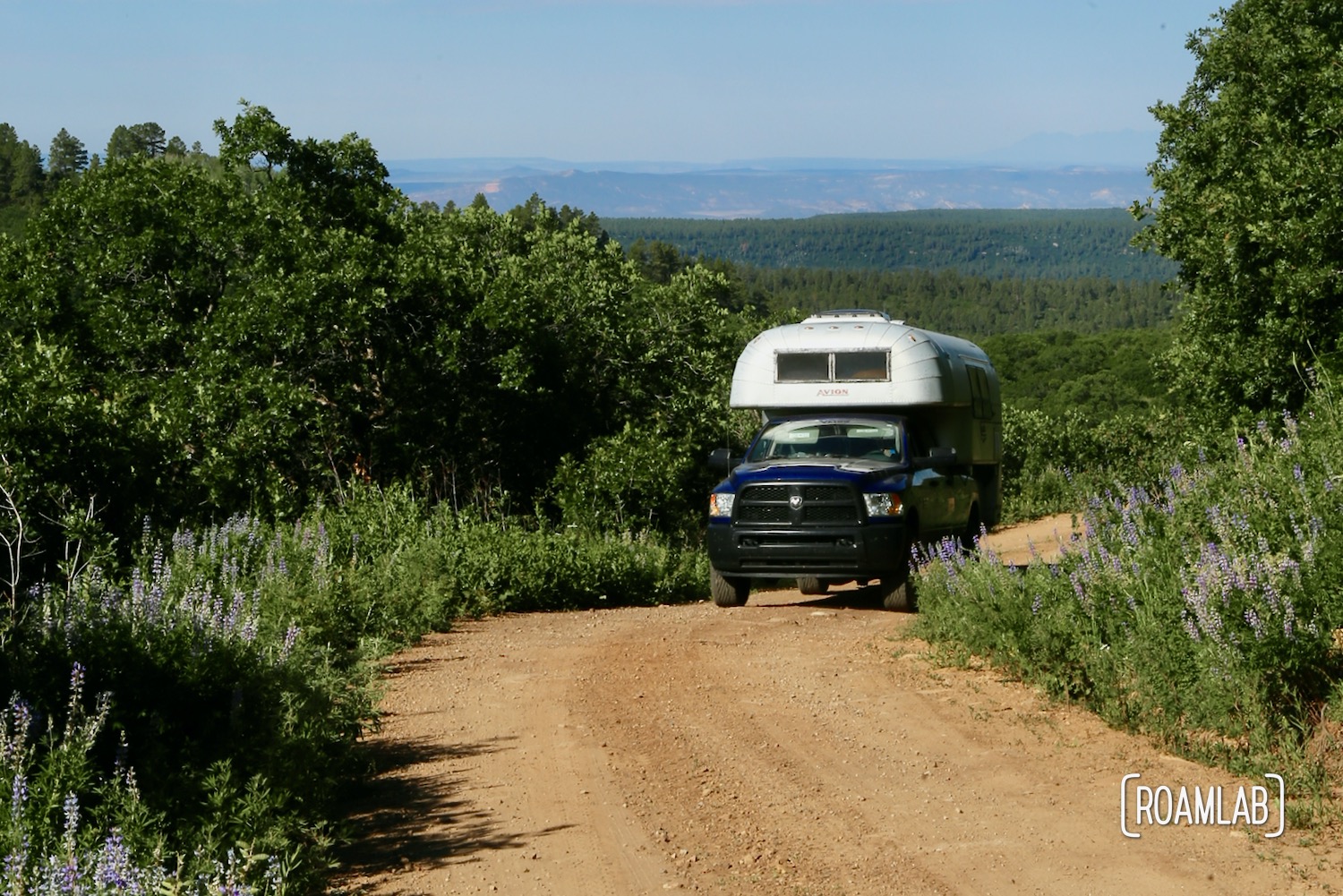
Midway between Nucla and the state line, the trail joins with Highway 141 for a brief distance before continuing west. The descent to this crossing and ascent from it are both, arguably, the most harrowing portions on this stretch. Descending from the eastern bluffs requires a series of particularly tight switchbacks. Best of all, at least while we were there, a boulder in the middle of a rare straight portion required us to drive with one tire on the cliffside to get around.
The ascent from Highway 141 headed to Moab may have fewer switchbacks, but it is incredibly steep and constant. After a day of rocking along rugged roads, we anxiously monitored the constant tug of the camper against the tie-downs, keeping the slide in camper from sliding out. Everything held up well, aside from my nerves.
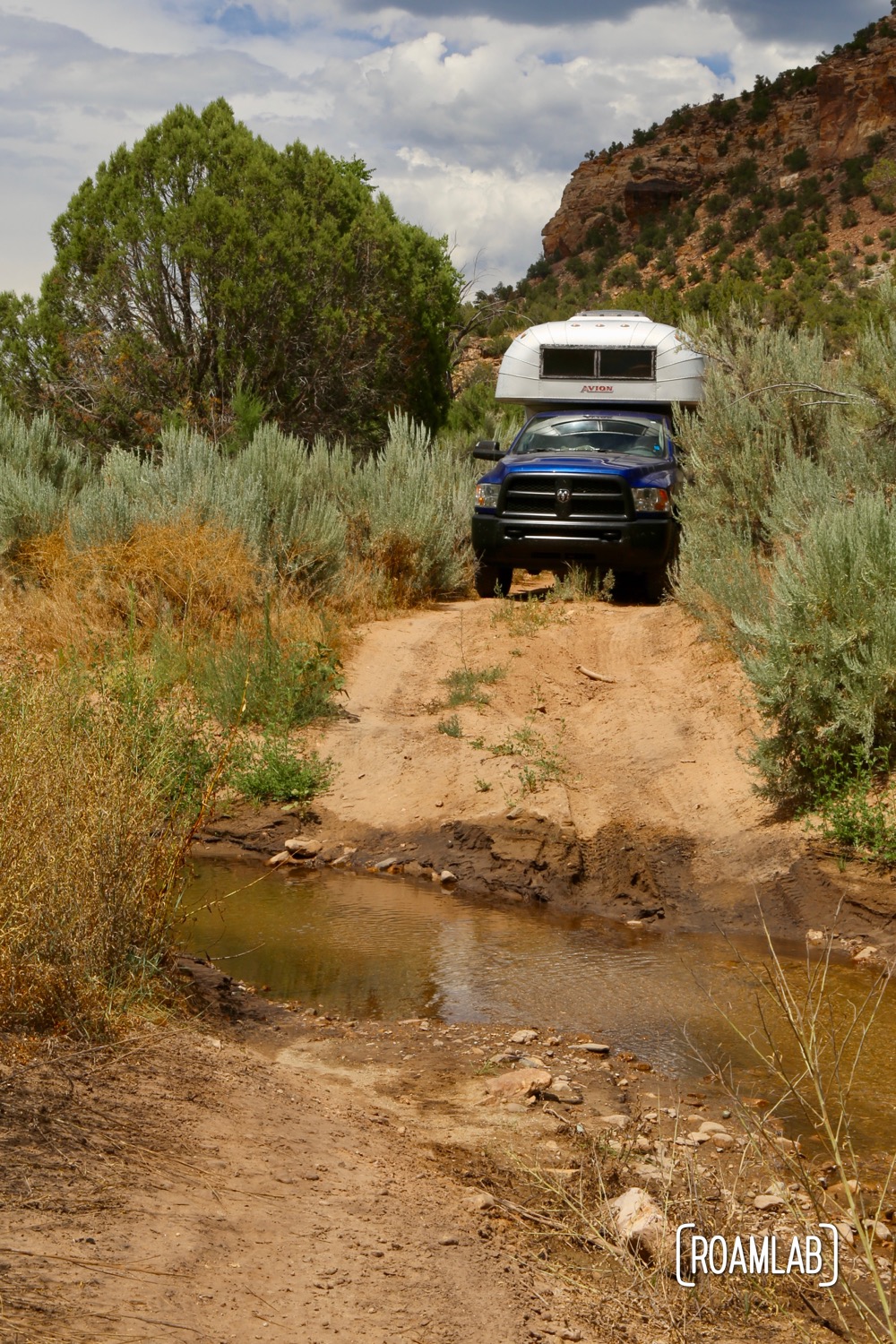
There are a few creak crossings along the trail. While the water is never that deep, the entries always have me concerned that we will bottom out and damage the rear end of the camper.

Yes, the trail got steep at points!
Several portions of the trail lead me to seriously questions whether we missed a turn. The roughness of this portion of trail was the first, but certainly not the last.
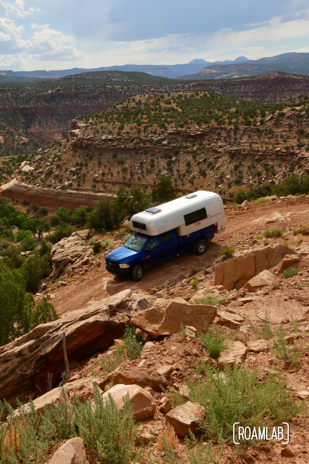
The vistas may be mind blowing but the descents are harrowing.
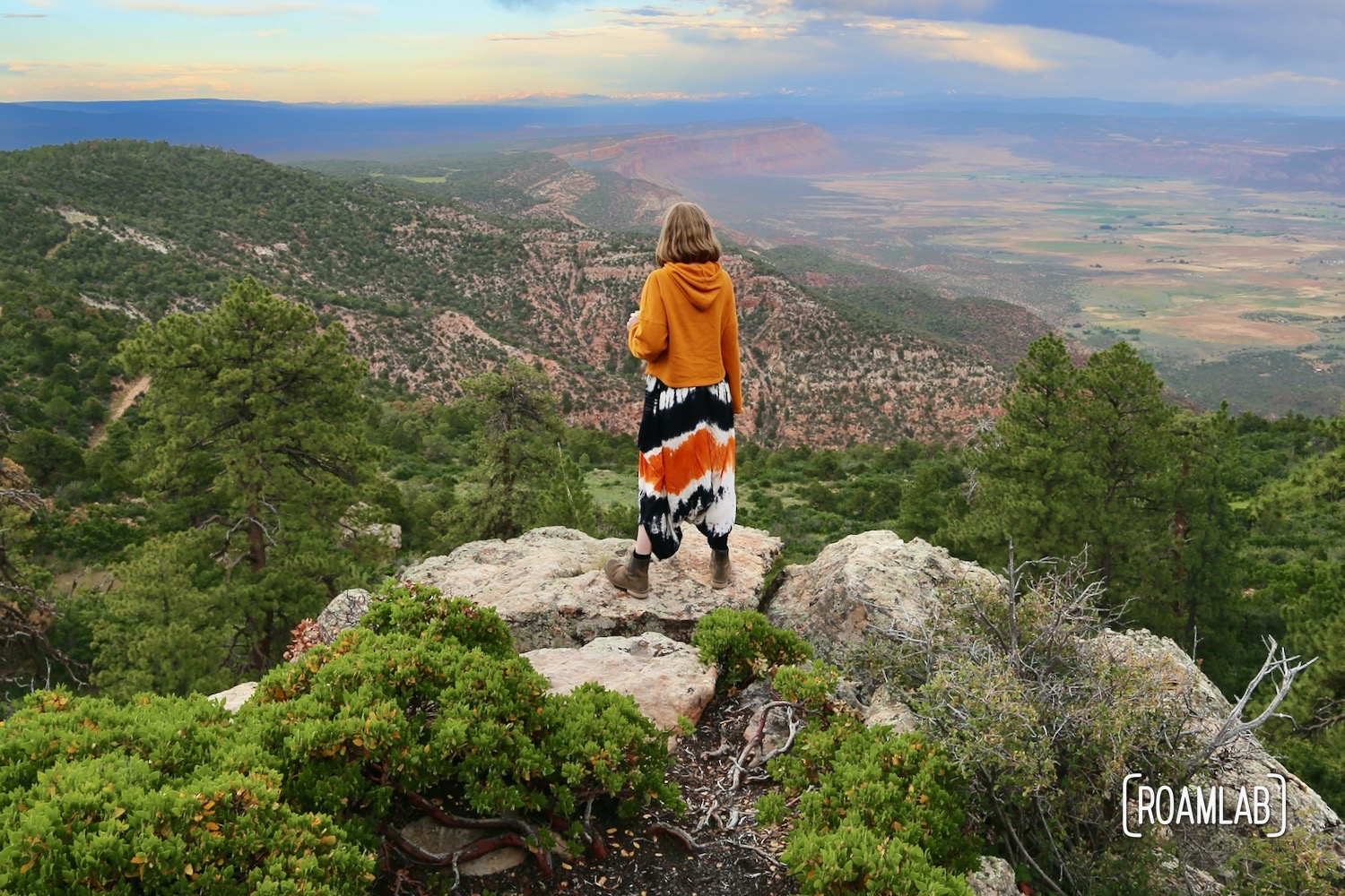
The series of turns and relatively flat dirt route following the ascent form Highway 141 lulls us into a false sense of security as evening approaches. We are just a few miles outside of Manti-La Sal National Forest and public land when we encounter the heart-stopping crawl along a narrow ledge at the top of a sheer cliff over Paradox Valley. The road at this point is so narrow that I jump out of the truck to guide Chris. We wearily eye the tree-line in the distance, monitoring for oncoming traffic—too concerned for life and limb to properly appreciate the panoramic valley views spread out directly below us.
It’s times like this that I fervently wish we had a narrower wheelbase. There was no way in hell that another vehicle, even an ATV, could drive around us on this stretch and even lower odds of us backing up. Fortunately, the conclusion of this cliff clinging crawl is National Forest. We quickly settled into the first viable campsite we encounter and prepare for dinner and a well-deserved rest.
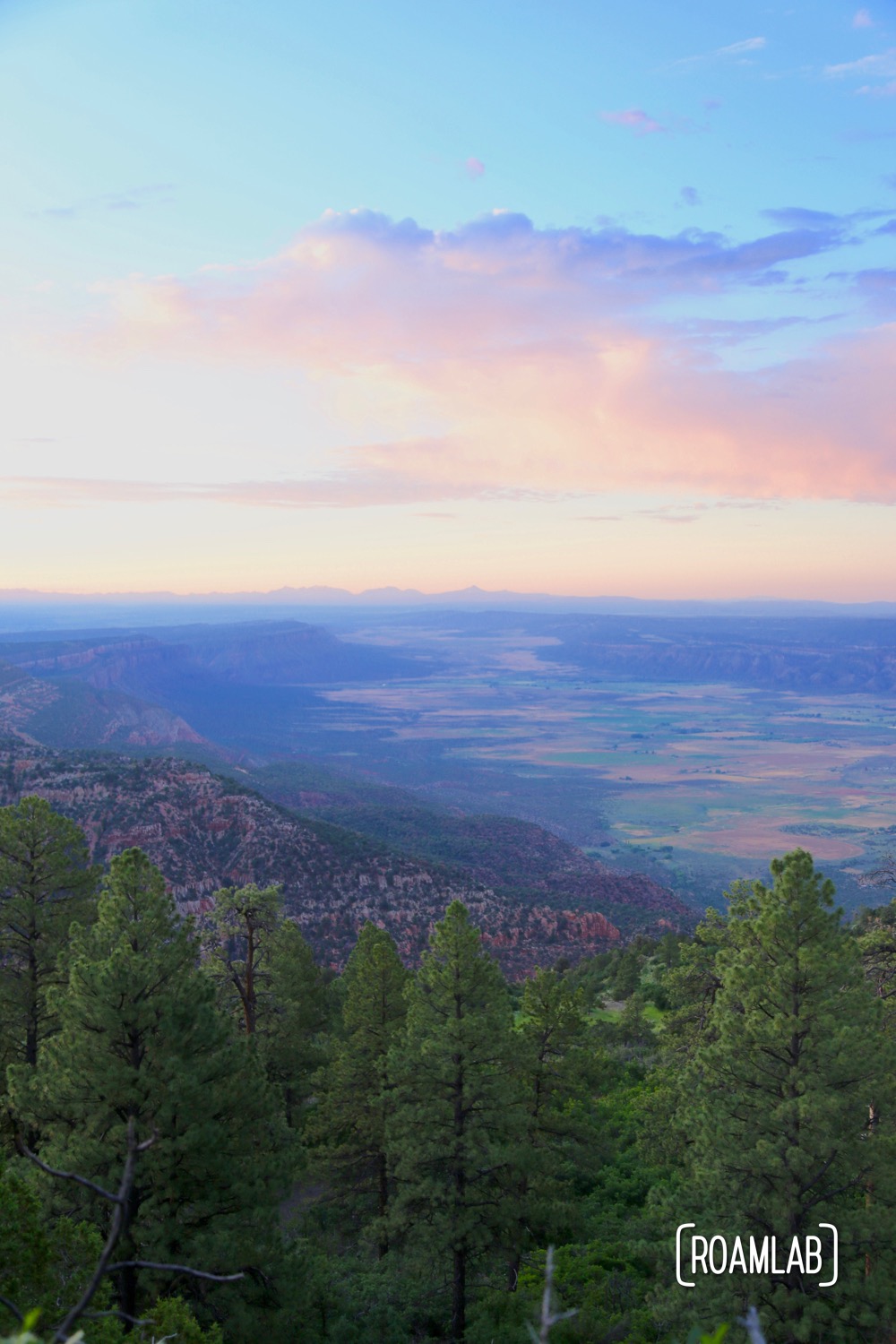
Sunset view of Paradox Valley from our campsite.