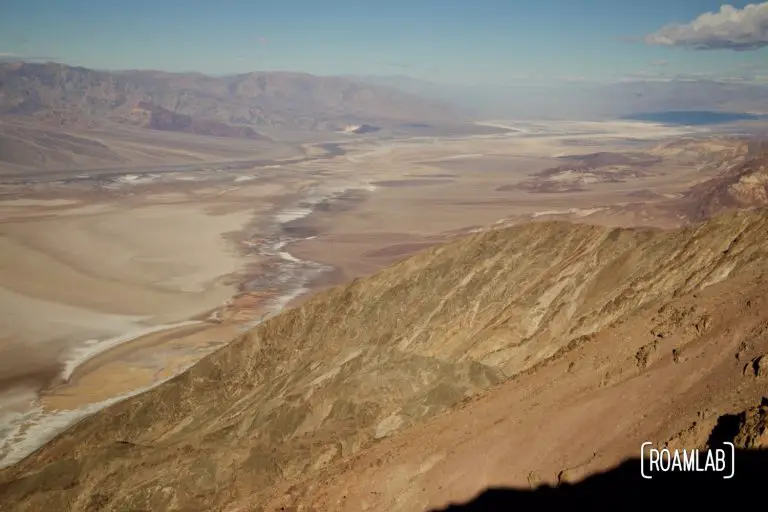
Category Parks

Zabriskie Point

Towering golden rock formation of Zabriskie Point with the Panamint Range in the background.

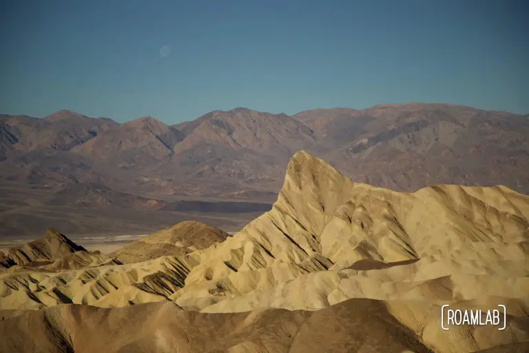
There's no shortage of dramatic rock formations in Death Valley National Park. But one that is (arguably) the most iconic is Zabriskie Point. This striking struckure rises out of ancient badlands older than Death Valley itself. It was formed by erosion of sediment left by Furnace Creek Lake when it dried up 5 million years ago, long before Lake Manly and Death Valley as we know it. Today, it is the gem of the Ameragosa Range, the eastern mountain range flanking Death Valley National Park

Read MoreZabriskie Point

Dust Storms

Boardwalk winding next to a sand dune.

We aren't too alarmed when we hear about the wind advisory in Death Valley. After our December experiences with tornados in Kentucky and Kansas, we don't think much of winds in sunny California. Even so, we don't have to be in Tornado Alley for winds to whip up quite a storm. Rather than dropping tree limbs and flipping trailers, this wind kicks up a dust storm so great as to block out the surrounding mountain range and, later on, the sun. We wander Death Valley through a muted haze. Even in that midday twilight, we wear sunglasses and masks to protect our eyes and airways from the grit and dust kicked up by the wind.

Read MoreDust Storms

Dante’s View

Colorful salt flats paint the floor of Death Valley as seen from Dante's View.

So many of the iconic stops in Death Valley are on the valley's floor. Badwater, the Sailing Stones, and the Devils Golf Course are all fairly low elevation. For many, the opportunity to see the park from above is most common while driving CA-190 over the Panamint Range and into the Badwater Basin. While the drive includes many stunning vistas, they are hard to compare to the colorful marbleized salt flats of the Death Valley floor and Badwater Basin as seen from Dante's View.

Read MoreDante’s View

Montaña de Oro State Park

Man in a green shirt walking the coastline of Montaña de Oro State Park at sunset.

The California Coastline is awash in scenic draws. We could spend years exploring the state's coastal forests and delicate tidepools and constantly find new, remarkable places. That said, there is one park that regularly draws in, whenever we are in the area. Montaña de Oro State Park is located in Los Osos, south of Morro Bay and north of Pismo Beach and offers the full California coast experience: rugged rocky cliffs, sandy beaches, and thriving local wildlife.

Read MoreMontaña de Oro State Park

A Trip Down Skyline Drive

Vintage 1970 Avion C11 truck camper driving through a tunnel in Shenandoah National Park.

Shenandoah National Park rises above the valleys and urban development of northern Virginia as part of the Blue Ridge Mountains. From its inception, park administration has carefully developed portions of this wilderness as a destination for motorists. Skyline Drive is the main artery through the park, following the ridgeline and connecting Front Royal in the north and Waynseborrow in the south.* The route was built at the dawn of popular motor travel and features prolific pullouts and almost 70 overlooks that continue to serve modern road trippers. We join other leaf peepers in the fall to drive the full 105-miles of Skyline Driver just as the leaves begin to turn.

Read MoreA Trip Down Skyline Drive

Dark Hollow Falls

Fall colors view of the Dark Hollows Falls in Shenandoah National Park.

Shenandoah National Park highlights expansive vistas of the Virginia countryside from its Skyline Drive. But one doesn't have to wander far to be immersed in natural gullies experience a more intimate side of the park. Leave the vast overlooks behind and get up close and personal with the Dark Hollow Falls Trail.

Read MoreDark Hollow Falls