Salt River winds through the heart of eastern Arizona from its headwaters in the White Mountains to Phoenix, where it merges with the Gila River. Much of this land is wild, remote, and breathtakingly beautiful. And while we only explore a short stretch between Roosevelt Lake and the Superstition Mountains. It’s just a matter of time before we return to explore more of its 200-mile length.
About the Salt River
The Salt River originates from the confluence of the White and Black Rivers in the White Mountains of eastern Arizona. It flows westward through the Tonto National Forest, eventually emptying into the Gila River. The river traverses alpine forests, high desert plateaus, and rugged canyons, offering a range of ecosystems and scenery. The Salt River Canyon—often called the “other Grand Canyon”—boasts dramatic cliffs, colorful rock formations, and lush riverside vegetation. The river corridor is home to diverse wildlife, including bald eagles, bighorn sheep, deer, and reptile species.
While much of this territory may feel wild and untouched, the remains of past human settlements dot the mountainsides. The Salt River has played a vital role in the history of Arizona, from prehistoric Native American settlements to early 20th-century mining and railroad developments. There are many opportunities to explore remnants of these past civilizations, including cliff dwellings, petroglyphs, and old mining structures.
Recreating on the Salt River
With its terminus along the southwest outskirts of Phoenix, the Salt River can be profoundly accessible. Most of the Salt River traverses the Tonto National Forest and other public lands, opening the waterway and shoreline to a wide variety of recreation options. Trails, campgrounds, marinas, picnic areas, and other facilities dot the riverside, particularly along Lake Roosevelt, a damned reservoir fed by the Salt River. Fishers can take in stunning buttes while angling for bass, catfish, and crappie. In particular, the Salt River Canyon Wilderness Area is a favorite among hikers and backpackers. And, of course, the river is a natural draw for rafters and other paddlers.
Along its 200 miles, the Salt River offers thrilling whitewater rafting opportunities, with rapids ranging from Class II to Class IV. The river’s most popular rafting section is the Upper Salt River, which features a 52-mile stretch of rapids and stunning landscapes. Though, access to this section can depend on snowmelt and water levels.
Apache Trail
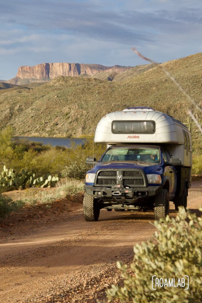
The Apache Trail (or Arizona Highway 88) roughly follows the Salt River connecting Apache Junction to the Roosevelt Reservoir. It’s a narrow, mostly dirt and gravel route with switchbacks and steep cliffs. It’s a trail where we hold our breath around every blind curve, hoping not to encounter another vehicle and negotiate how close to the edge we can safely drive to pass each other. But, like so many of these nerve-wracking routes, the views are amazing, and much of that is thanks to the Salt River snaking below.
Our Experience
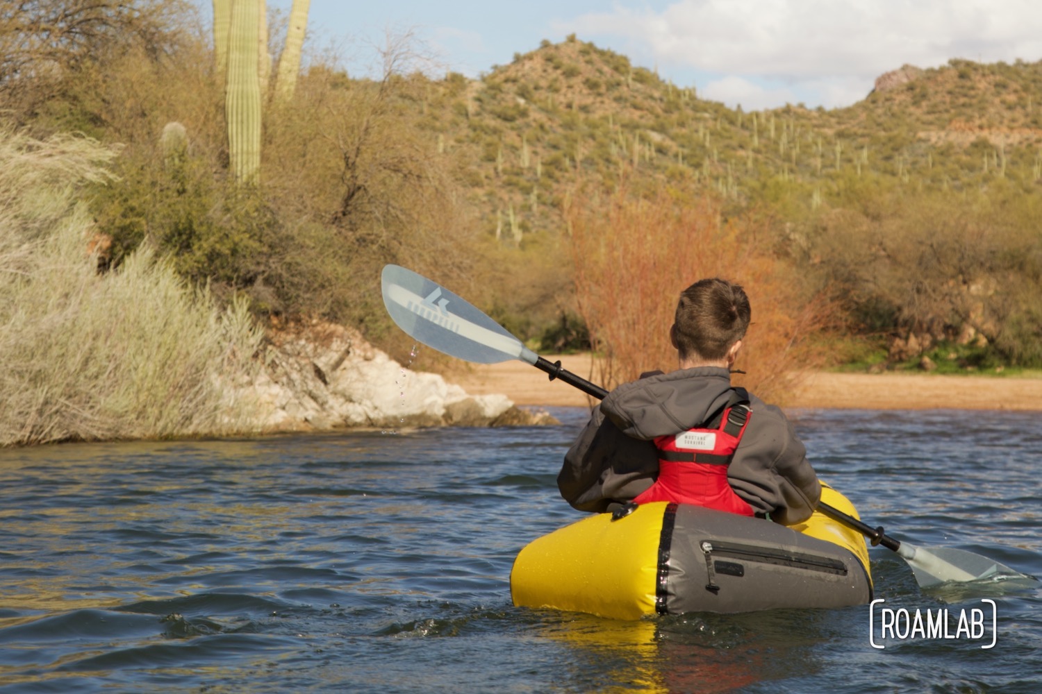
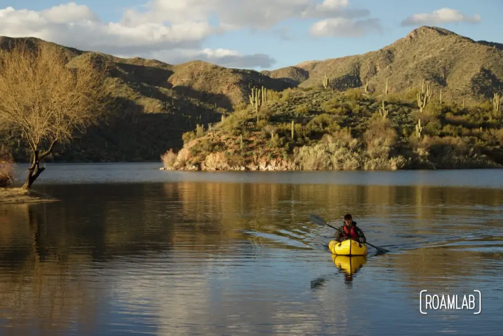
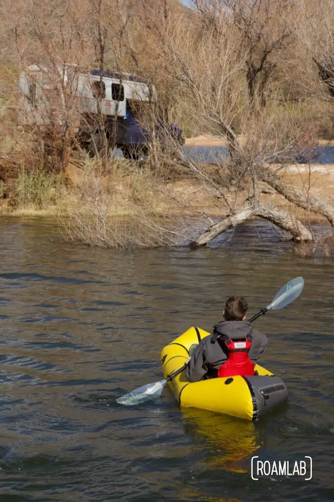
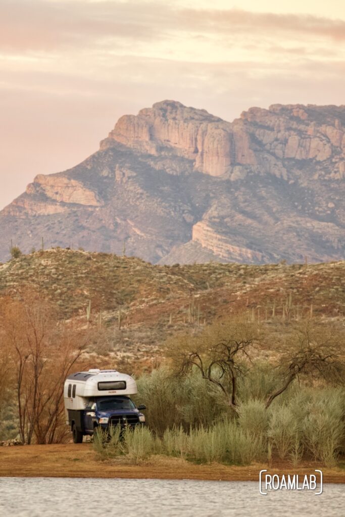
We wind down to the Salt River from the eastern terminus of the Apache Trail, just past the Roosevelt Dam. In 2019, a confluence of wildfire and flooding resulted in a landslide cutting off the Apache Trail. While much of it has been reopened, the middle section remains closed indefinitely. Fortunately, we can reach the Burnt Coral Campground and boat launch by approaching from the east. This campground was under construction the last time we drove the Apache Trail. Now it boasts new facilities, including registration terminals where we buy our recreation permit. With the permit prominently placed on the truck dash, we can inflate our rafts and explore the river.
Water conditions
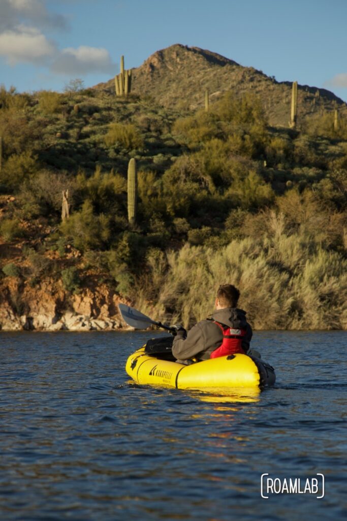
It’s a windy afternoon as we set off along the river. Air currents funneled between the mountainsides rising up along the river churn up the slow-moving water into lightly choppy waves. While parts of the Salt River feature Class IV rapids, we might as well be paddling a narrow lake. In a way, it is. Only five miles upriver is the Theodore Roosevelt Dam, and the Horse Mesa Dam manages the flow of the Salt River less than 20 miles down the river. Indeed, the wind moves our rafts with far more force than the water itself.
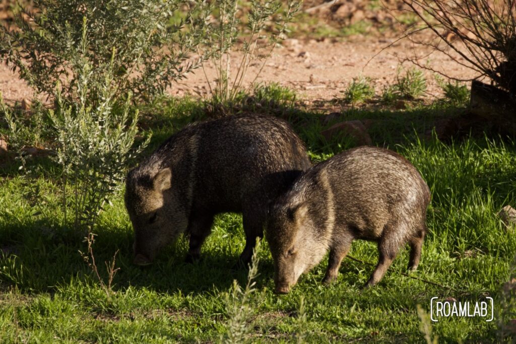
We leisurely examine the hillsides covered in Saguaro cactus, mesquite, and cholla. While preparing to paddle, we spotted a group of javelina grazing nearby. And we still debate whether we saw a bald eagle flying overhead. It probably was, but we couldn’t be sure.
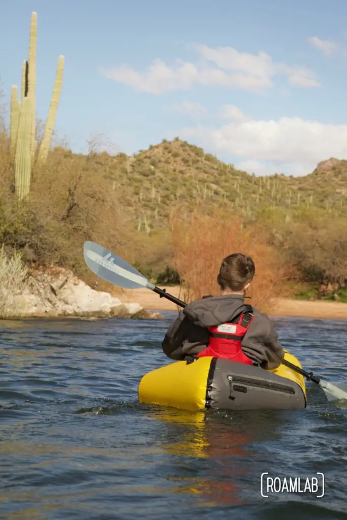
It’s a beautiful and relaxing stretch of river for a lazy day. Maybe next time, we’ll take on something more challenging.