Wilderness Loop Trail
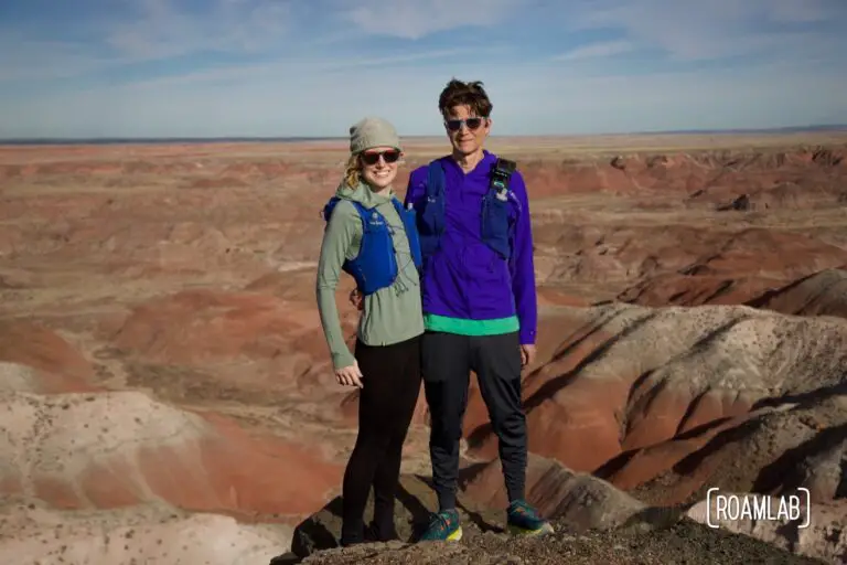
A trail running adventure into the colorful desert of the 7-mile Wilderness Loop of Petrified Forest National Park in Arizona.
A trail running adventure into the colorful desert of the 7-mile Wilderness Loop of Petrified Forest National Park in Arizona.
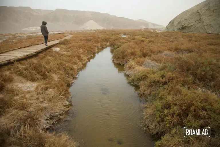
In a notoriously hot and dry environment such as Death Valley National Park, Salt Creak's presence on the desert floor is a surprise. The creek is fed by brackish springs over a mile upstream, resulting in a marshy habitat and home to the rare Salt Creek Pupfish. The creek may be too salty for us to drink and can be saltier than the ocean, yet it still supports a thriving ecosystem.
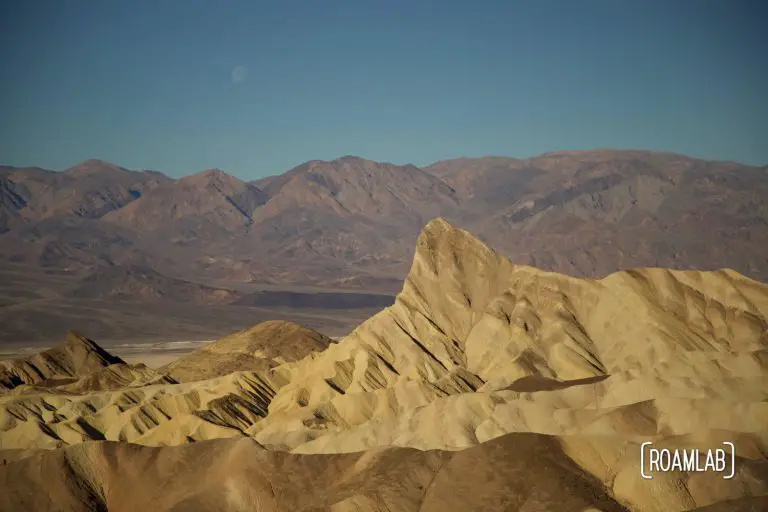
There's no shortage of dramatic rock formations in Death Valley National Park. But one that is (arguably) the most iconic is Zabriskie Point. This striking struckure rises out of ancient badlands older than Death Valley itself. It was formed by erosion of sediment left by Furnace Creek Lake when it dried up 5 million years ago, long before Lake Manly and Death Valley as we know it. Today, it is the gem of the Ameragosa Range, the eastern mountain range flanking Death Valley National Park
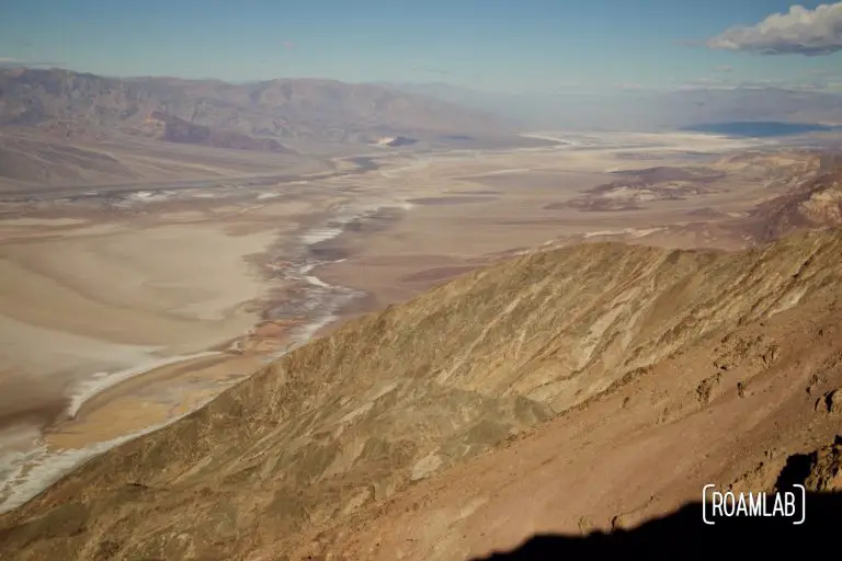
So many of the iconic stops in Death Valley are on the valley's floor. Badwater, the Sailing Stones, and the Devils Golf Course are all fairly low elevation. For many, the opportunity to see the park from above is most common while driving CA-190 over the Panamint Range and into the Badwater Basin. While the drive includes many stunning vistas, they are hard to compare to the colorful marbleized salt flats of the Death Valley floor and Badwater Basin as seen from Dante's View.
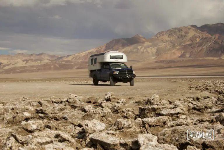
Devil's Golf Course is host to large rugged halite salt crystal formations in Badwater Basin on the floor of Death Valley National Park.
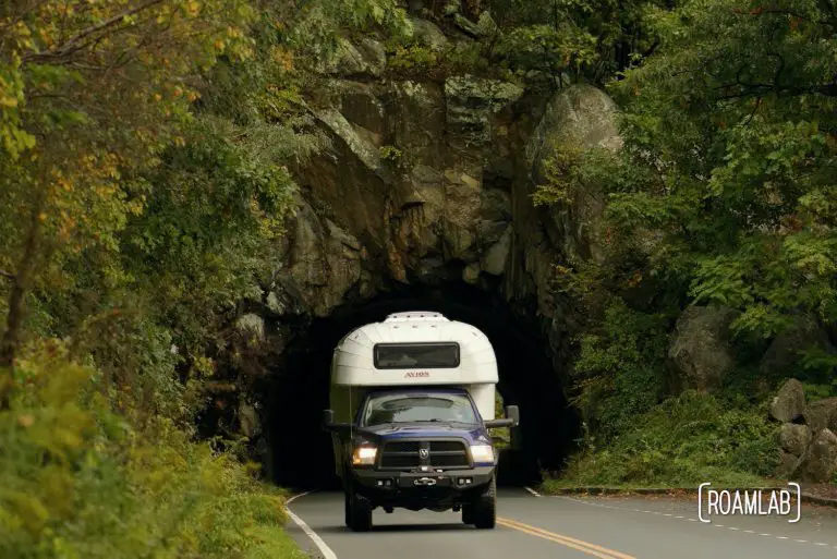
Shenandoah National Park rises above the valleys and urban development of northern Virginia as part of the Blue Ridge Mountains. From its inception, park administration has carefully developed portions of this wilderness as a destination for motorists. Skyline Drive is the main artery through the park, following the ridgeline and connecting Front Royal in the north and Waynseborrow in the south.* The route was built at the dawn of popular motor travel and features prolific pullouts and almost 70 overlooks that continue to serve modern road trippers. We join other leaf peepers in the fall to drive the full 105-miles of Skyline Driver just as the leaves begin to turn.
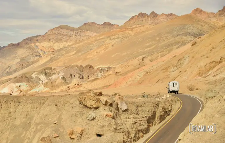
Explore Death Valley National Park's colorful hillsides along the 9-mile one-way Artists Drive.
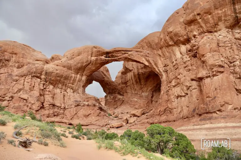
We wing things. That's what we do. I've made a map of places we would like to go to and then base our routes on our final destination and what mapped points fall between our current location and destination. Exactly how our trip plays out each time is something we play by ear. In this case, we had ten days to travel to Oregon. Half way in, we discovered that we would be swinging by Arches National Park. Arches ranks as one of the most exciting National Parks that neither of us has ever visited. So, of course, we went.
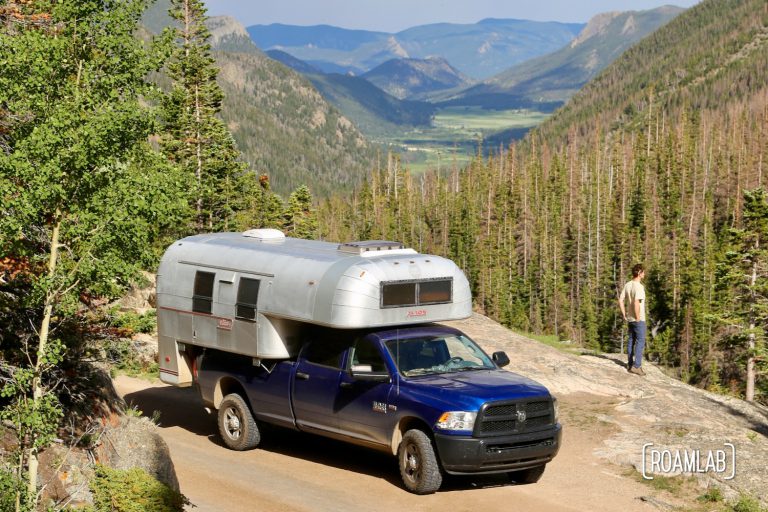
Rocky Mountains National Park’s Old Fall River Road traverses 11 scenic miles from the valley floor to alpine heights. Built back in 1920, this road was early visitors automobile introduction to Rock Mountain National Park. Since its creation, the paved Trail Ridge Road has become the parks main thoroughfare. Yet, Old Fall River Road remains a scenic back road through the park, bypassing much of the congestion and chaos of the popular paved alternative.

Driving the Shafer Trail between Canyonlands National Park and Moab is absolutely hair raising. The descent from the park's visitors center to the canyon floor is a heart stopping collection of narrow switchbacks. Better yet, the narrow trail is flanked by a sheer, 1,000-foot cliff on one side and a rock wall on the other. And if that is not enough disincentive, there is little between you and a precipitous drop other than a few tenacious sage brush.