Titus Canyon Road
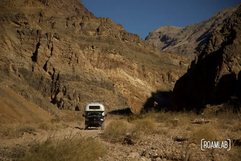
Death Valley is a park meant for vehicles. Stretching 140 miles in length, the Valley is full of attractions that require some kind of vehicle to see in a timely manner. But vehicular diversions are not limited to the pavement.…

Death Valley is a park meant for vehicles. Stretching 140 miles in length, the Valley is full of attractions that require some kind of vehicle to see in a timely manner. But vehicular diversions are not limited to the pavement.…
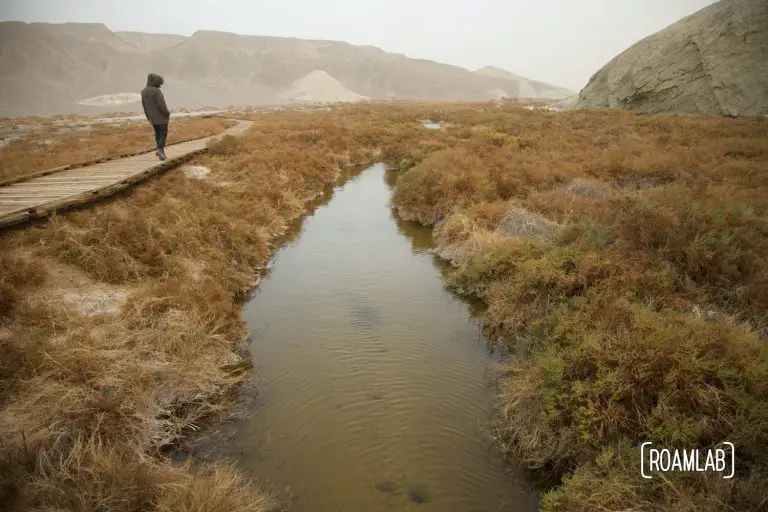
In a notoriously hot and dry environment such as Death Valley National Park, Salt Creak's presence on the desert floor is a surprise. The creek is fed by brackish springs over a mile upstream, resulting in a marshy habitat and home to the rare Salt Creek Pupfish. The creek may be too salty for us to drink and can be saltier than the ocean, yet it still supports a thriving ecosystem.
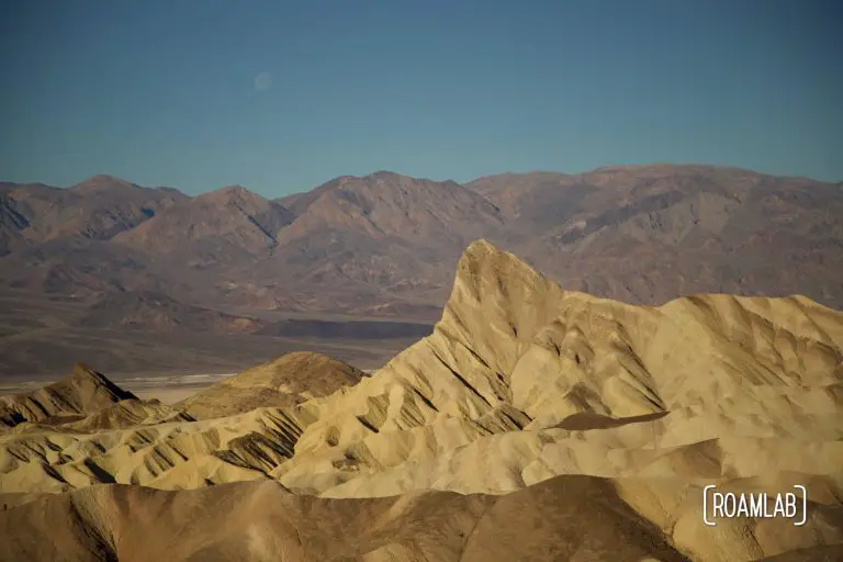
There's no shortage of dramatic rock formations in Death Valley National Park. But one that is (arguably) the most iconic is Zabriskie Point. This striking struckure rises out of ancient badlands older than Death Valley itself. It was formed by erosion of sediment left by Furnace Creek Lake when it dried up 5 million years ago, long before Lake Manly and Death Valley as we know it. Today, it is the gem of the Ameragosa Range, the eastern mountain range flanking Death Valley National Park
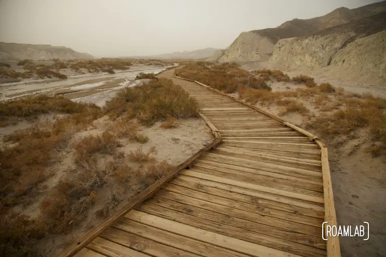
We aren't too alarmed when we hear about the wind advisory in Death Valley. After our December experiences with tornados in Kentucky and Kansas, we don't think much of winds in sunny California. Even so, we don't have to be in Tornado Alley for winds to whip up quite a storm. Rather than dropping tree limbs and flipping trailers, this wind kicks up a dust storm so great as to block out the surrounding mountain range and, later on, the sun. We wander Death Valley through a muted haze. Even in that midday twilight, we wear sunglasses and masks to protect our eyes and airways from the grit and dust kicked up by the wind.
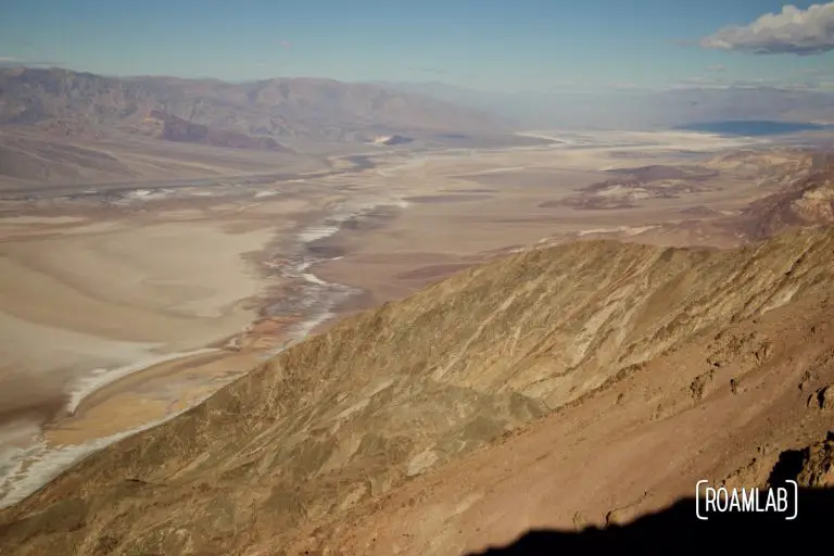
So many of the iconic stops in Death Valley are on the valley's floor. Badwater, the Sailing Stones, and the Devils Golf Course are all fairly low elevation. For many, the opportunity to see the park from above is most common while driving CA-190 over the Panamint Range and into the Badwater Basin. While the drive includes many stunning vistas, they are hard to compare to the colorful marbleized salt flats of the Death Valley floor and Badwater Basin as seen from Dante's View.
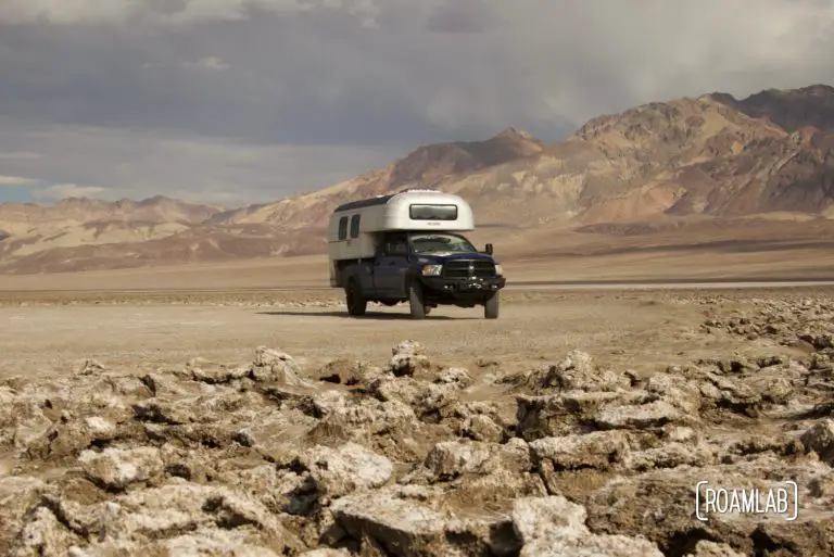
Devil's Golf Course is host to large rugged halite salt crystal formations in Badwater Basin on the floor of Death Valley National Park.
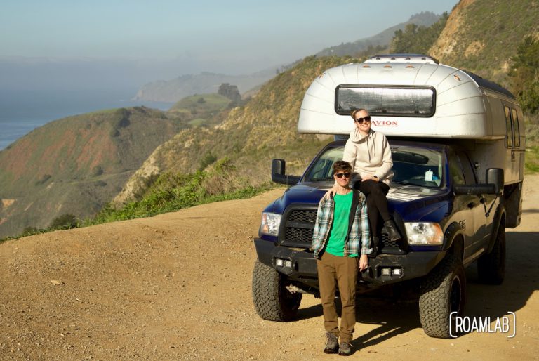
As avid outdoors people, we love to camp along the California Coast, but it isn't easy. As one might guess, a lot of people share our interest in camping on the California Coast and campsites are limited. Popular sites book up far in advance, but there are enough options out there to not completely ruin ones camping plans. So, here are our tips, tricks, and a few campsite recommendations for camping on the California Coast.
There are many ways to see California. It is a state with remarkable diversity. Colorful deserts, dramatic mountain ranges, rugged ocean coastlines, and towering redwood forests are all within a day’s drive. When you want to travel the length of…

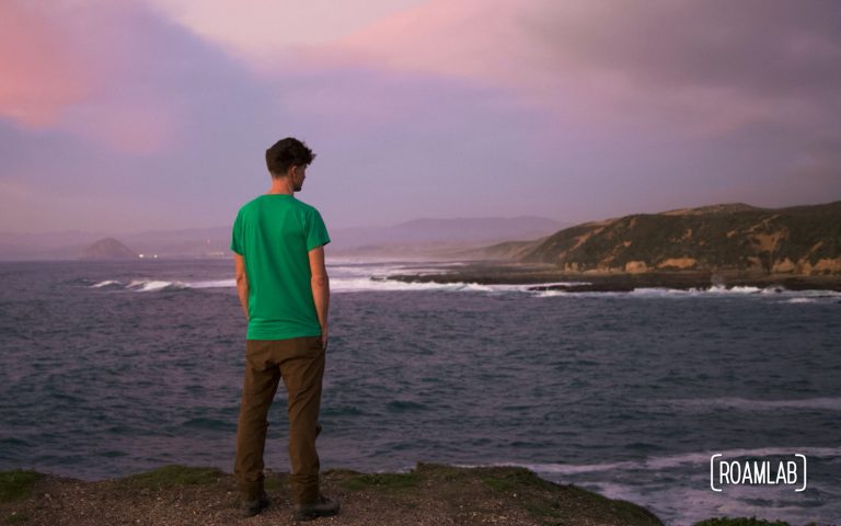
Morro Bay is a haven for sea otters. The shallow entry to the bay is near impassable to larger predators, creating an environment safe for these furry ocean dwellers and other aquatic life. It’s an ideal location for watching sea…
The California Coastline is awash in scenic draws. We could spend years exploring the state's coastal forests and delicate tidepools and constantly find new, remarkable places. That said, there is one park that regularly draws in, whenever we are in the area. Montaña de Oro State Park is located in Los Osos, south of Morro Bay and north of Pismo Beach and offers the full California coast experience: rugged rocky cliffs, sandy beaches, and thriving local wildlife.