Mouse’s Tank (Petroglyph Canyon) Trail

Hike by petroglyphs, red rock walls, and a natural reservoir along the ½-mile in-out Mouse Tank Trail in Nevada's Valley of Fire State Park.
While traveling on the road, hiking trails are our gym. We love to get out in the middle of nowhere for impressive vistas and flirtations with wildlife.
Hike by petroglyphs, red rock walls, and a natural reservoir along the ½-mile in-out Mouse Tank Trail in Nevada's Valley of Fire State Park.
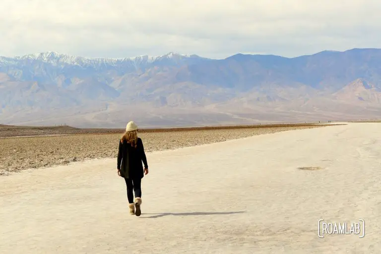
Walk along the lowest elevation location in North America, 282-feet below sea level, at Badwater Basin in Death Valley National Park.
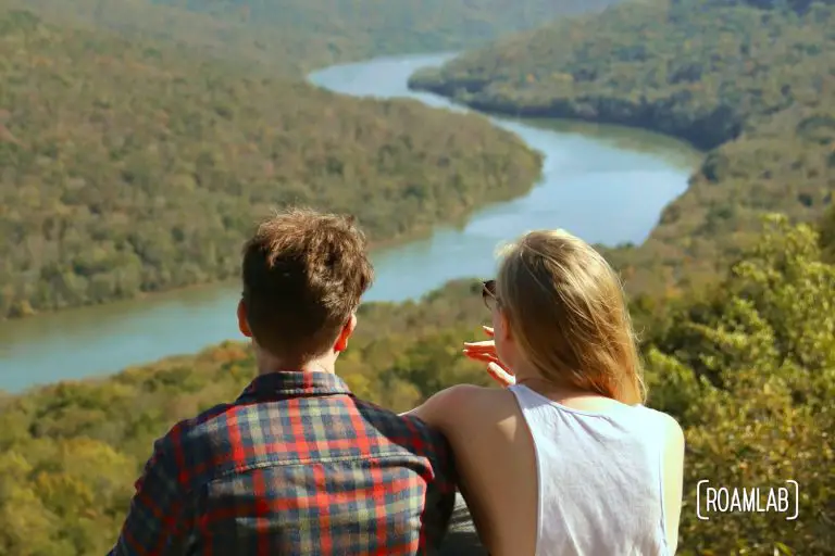
Ritchie Hollow hiking trail is a 2.7-mile point to point trail connecting a parking lot along the Tennessee River to the Davis Pond campground in Prentice Cooper State Forest. The route covers a 1,200-foot elevation gain that ramps up from a relatively level terrain to extended stretches of stairs and steep inclines. While there are occasional trail markers, junctions can be confusing, and it helps to tackle the trail with a map to cross-reference. Even so, for all its challenges, the Ritchie Hollow trail is awash in waterfalls and, with a well-deserved detour, it can conclude with one of the best views of the Tennessee River Gorge.
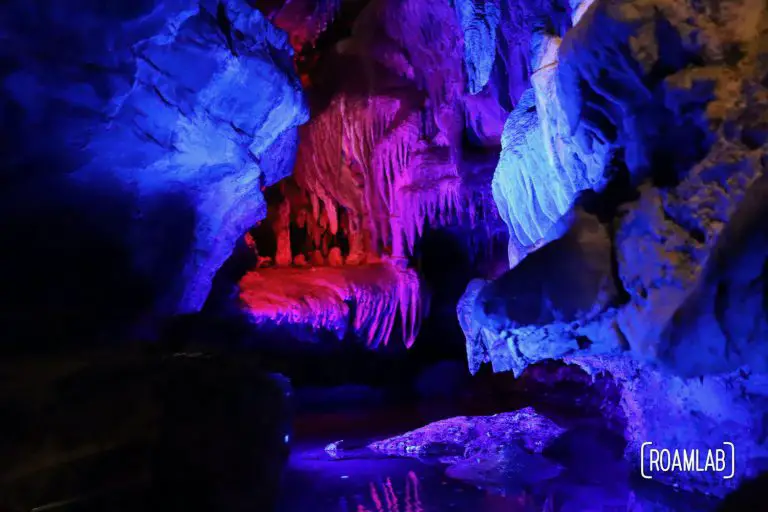
Ruby Falls is the tallest and deepest waterfall in North America, just outside of Chattanooga. See stalactites, stalagmites, and other rock formations.
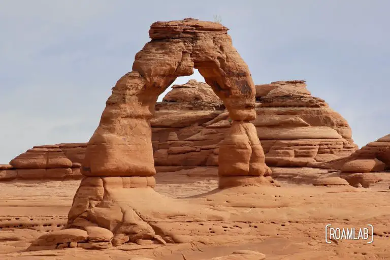
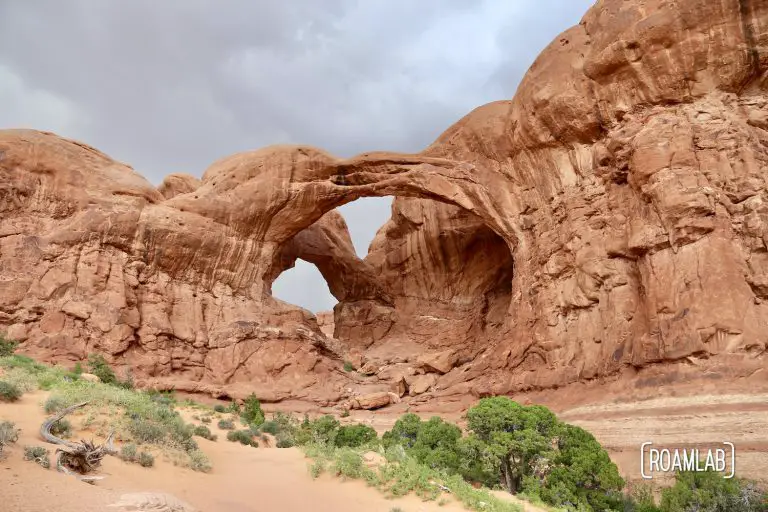
Call it "Cowboy's Chaps", "Old Maid's Bloomers", or "Salt Wash Arch", the Delicate Arch is Arches National Park's largest freestanding arch.
We wing things. That's what we do. I've made a map of places we would like to go to and then base our routes on our final destination and what mapped points fall between our current location and destination. Exactly how our trip plays out each time is something we play by ear. In this case, we had ten days to travel to Oregon. Half way in, we discovered that we would be swinging by Arches National Park. Arches ranks as one of the most exciting National Parks that neither of us has ever visited. So, of course, we went.
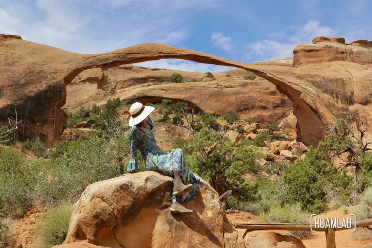
The Devil's garden boasts a notably high concentration of arches, spires, and fins (narrow rock walls) in Arches National Park. Between the main loop and its many offshoots to iconic spots such as the landscape arch and the Double O Arch, hiking the Devil's Garden Trail can take anywhere from 1.9 to 7.9 miles with easy and difficult routes. If you are only going to make one spot in the Devil's Garden, it should be the Landscape Arch.
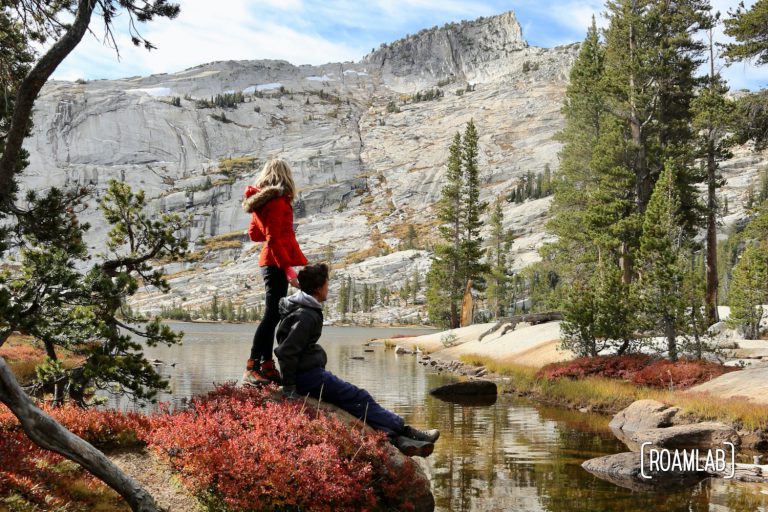
Hiking Cathedral Lakes Trail from Tuolumne Meadows to Lower Cathedral Lake, surrounded by Cathedral, Echo, and Tresidder Peaks in Yosemite National Park.
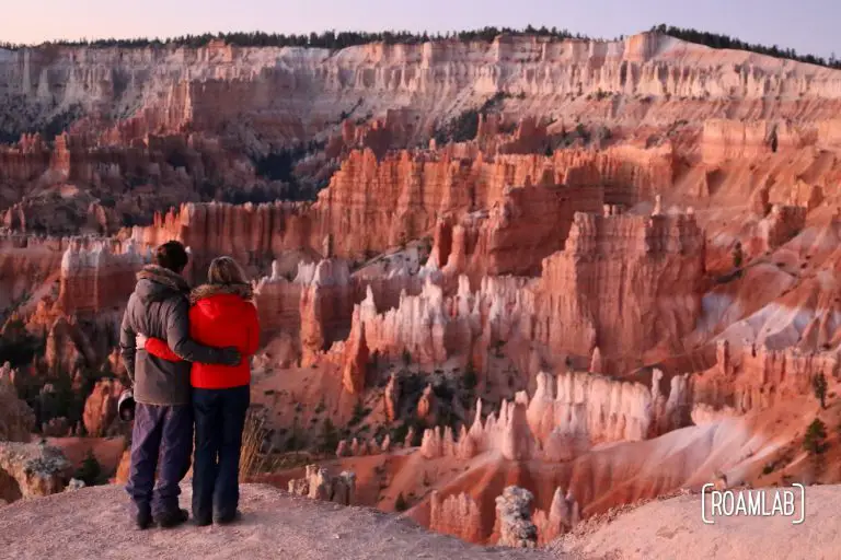
It's 5am and I lie in bed contemplating sleep. It would be so nice, but it seems to be avoiding me. To my right, Chris stirs. "Can't sleep?" Part of it is the sleeping. Part of it is the opportunity. We are parked right outside of Bryce National Park. The sun will be coming up in an hour or so. We have time to get there to see the sunrise. But it means facing the below freezing temperatures outside of our cozy bed. Even so, this very well may be a once in a lifetime opportunity. We are both tired, but even Chris doesn't grumble as we layer on ski pants, heavy coats, and dash for the truck cab.
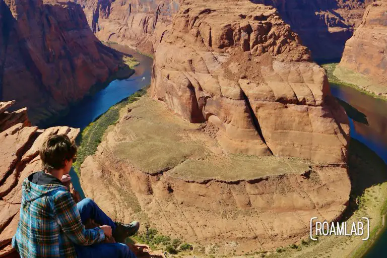
You have seen Horseshoe Bend before. Whether it was some friend's vacations pictures, a slick travel influencer on Instagram, or a poster, the 1,000-foot sheer sandstone walls and symmetrically looping river of Horseshoe Bend is immediately recognizable. It's also conveniently accessible.